Malaivalmakkal
Project size:3 acres
Near Perumalmalai, Palani Hills
May 2022 to April 2023
Key features:Zoning masterplan, earthworks design, built spaces, architectural design, forest-based livelihood support, native nursery, wild zones, buffer zones
Project team: Kiri Meili, Jananee Mohan, Sanjana Radhakrishnan, Theertha Ravindran
Architectural design team: Sanjana Radhakrishnan, Theertha Ravindran
Elevation: 1235 metres above sea level
Annual rainfall: 1617 mm / 63.7 inches
Climate: Monsoon influenced humid subtropical climate
Bioregion: Lower Palani hills - Shola forests, grasslands, riparian forests
Soil type: Humus-rich loamy sand
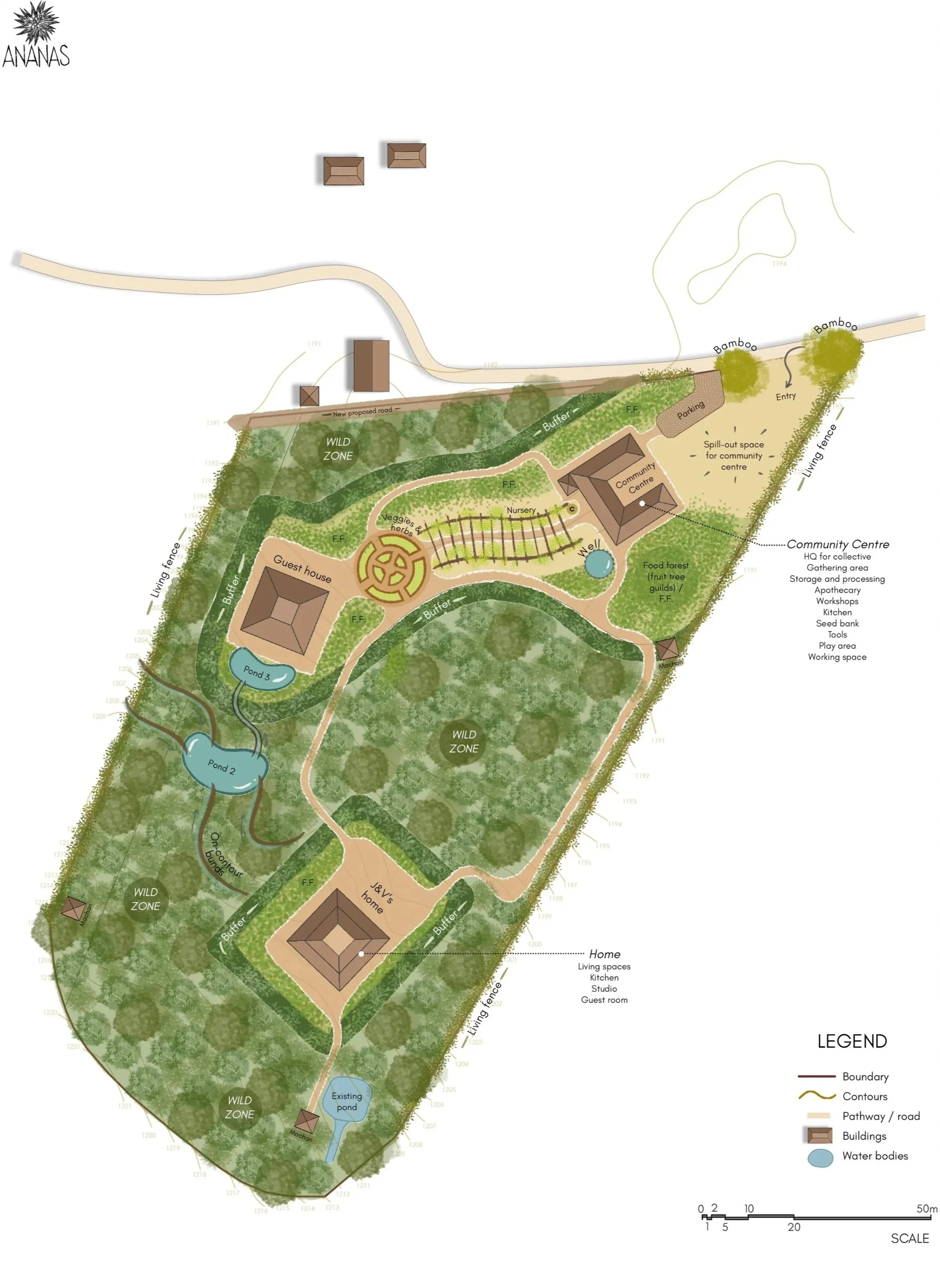
Malaivalmakkal was founded in the Palani Hills by the custodians of a 3-acre landscape with the intention of creating dignified livelihood opportunities for the indigenous community rooted in this region. The initiative engaged the design team at Ananas to develop a clear conceptual framework for the land, anchored in a zoning strategy that supports both ecological restoration and community driven programs.
At the heart of Malaivalmakkal’s vision is the revival of traditional forest-based food systems, the establishment of fair and community-governed income models, and the gradual regeneration of native Shola ecosystems. Together, these efforts strengthen cultural continuity while deepening the community’s relationship with land, food, and forest.
Initial phases centered on detailed landscape study, collaborative engagement with community members, and the development of integrated zoning strategies that bring together livelihood, culture, and ecological stewardship. Water held a special focus in the design phase, to ensure water self-sufficiency. The long-term goals focused on building resilient futures rooted in local knowledge and biodiversity.
This collaboration also led to a parallel architectural project, including the design of a residence, an artist residency studio, and a shared community space, detailed below.
Environmental Study and Zoning
Dense on-site vegetation made a conventional topographic survey unfeasible. The design team therefore relied on contour data derived through GIS analysis. Using this information, a detailed base map was prepared to document site observations and layer design strategies.
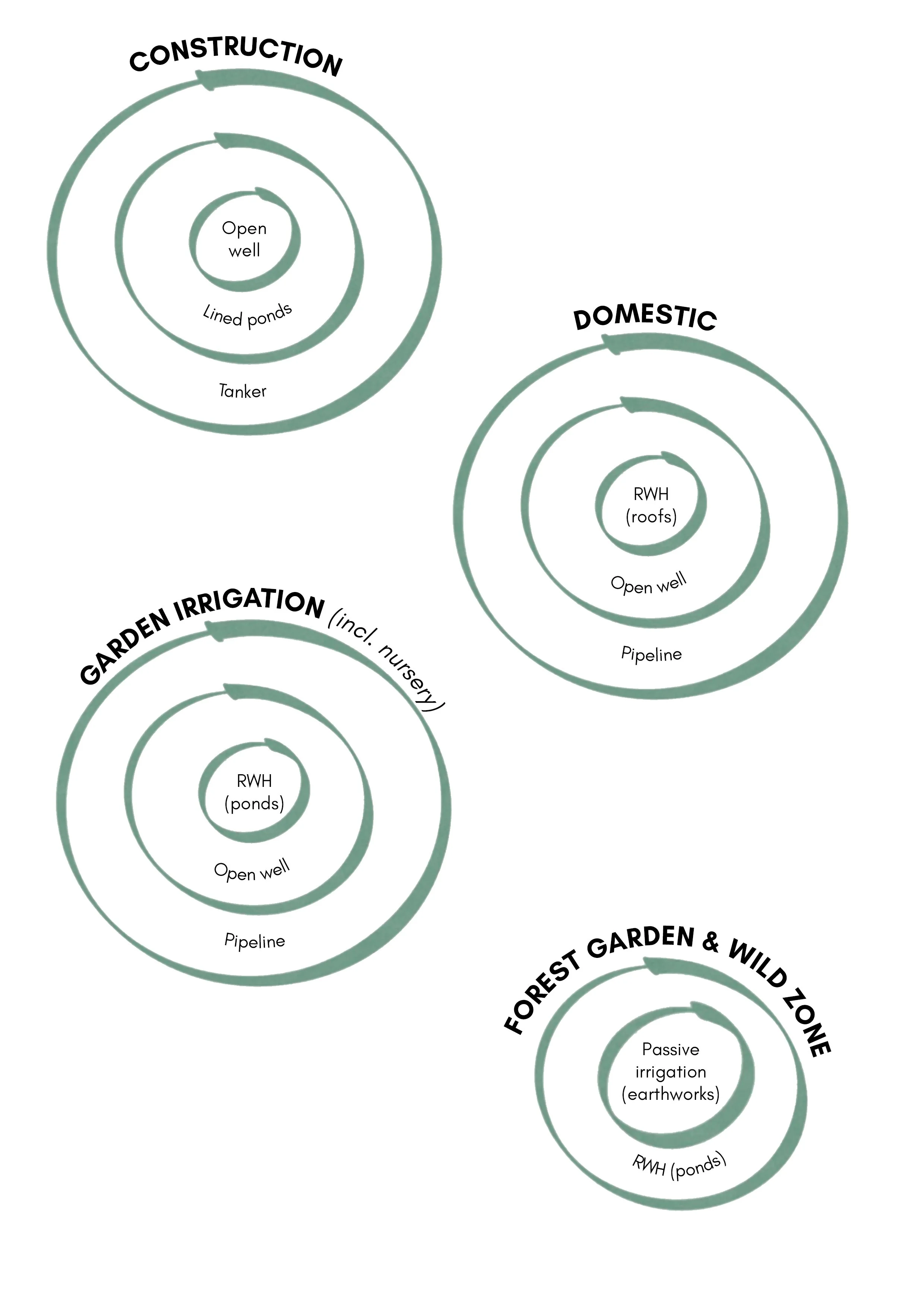
Water strategy
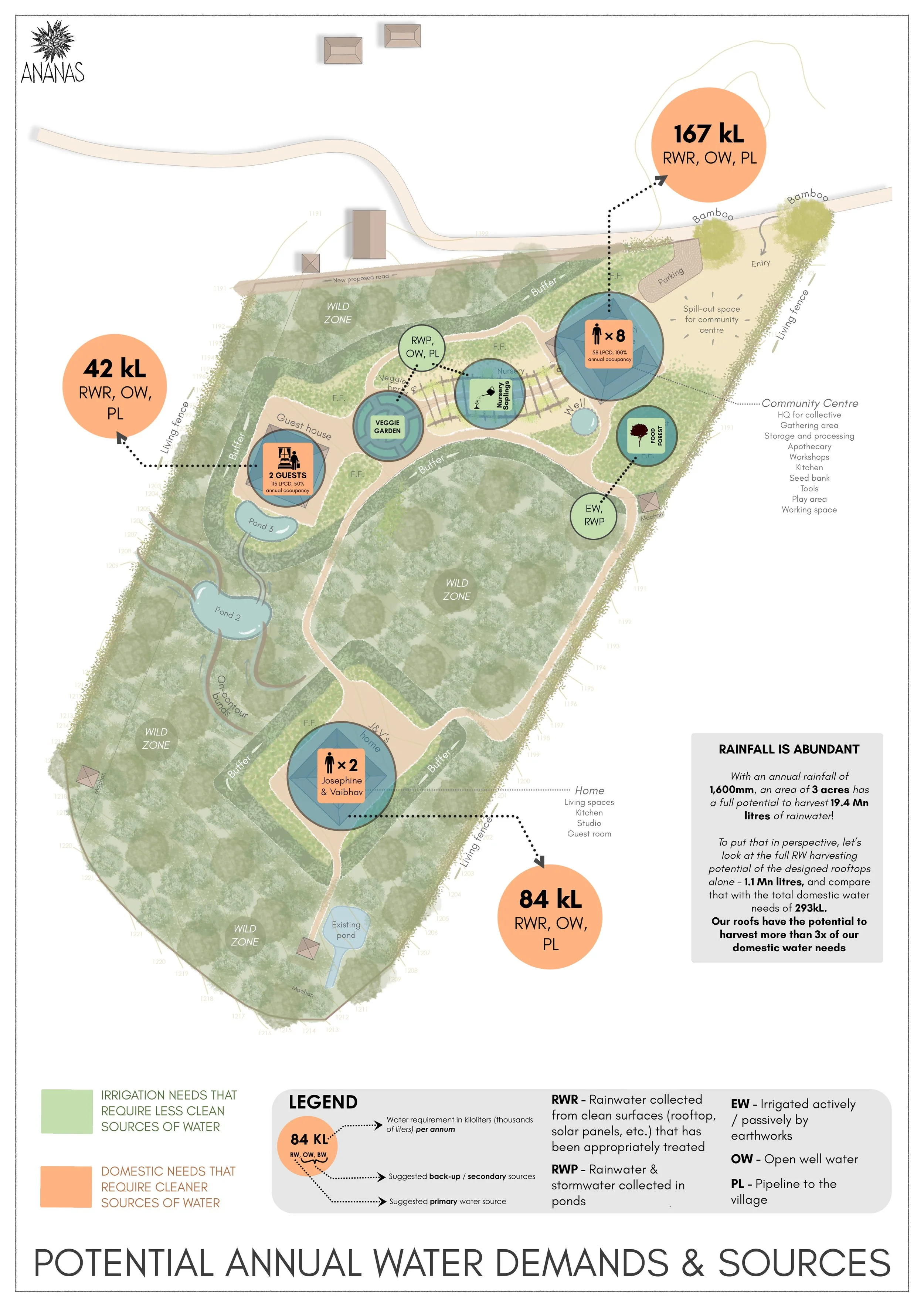
The zoning masterplan integrated existing ponds, open wells and local knowledge of aquifers to create the water strategy.
The framework accounted for the water requirements of key program elements, including the nursery, residence, community centre, and planted zones. To strengthen long term sustainability, three potential water sources were identified for each use and organised in order of priority.
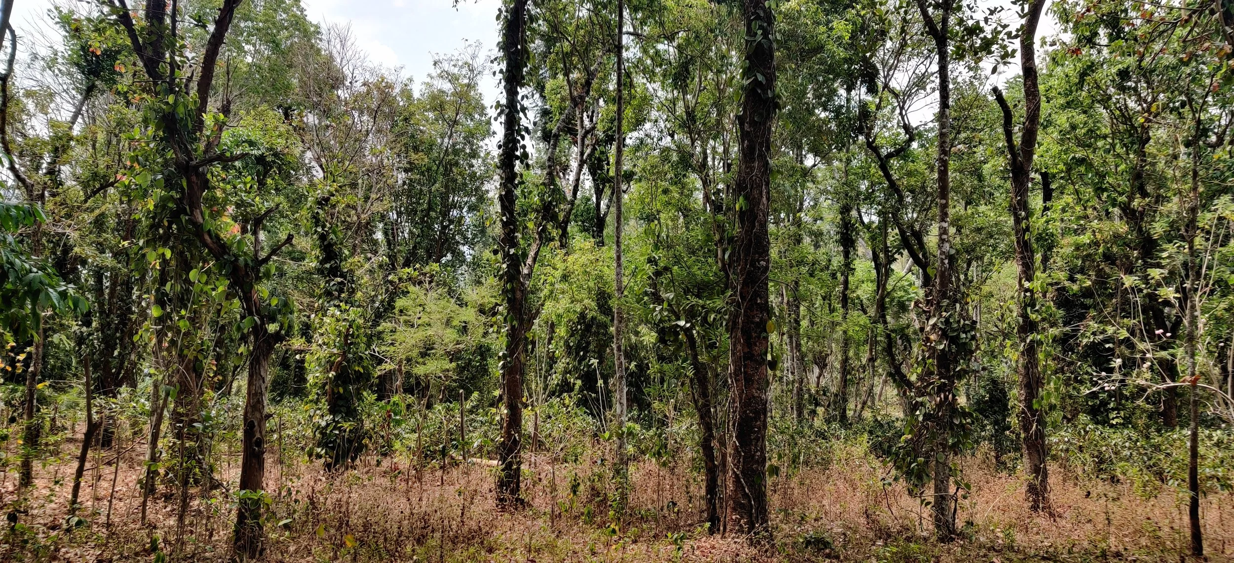
Site photos
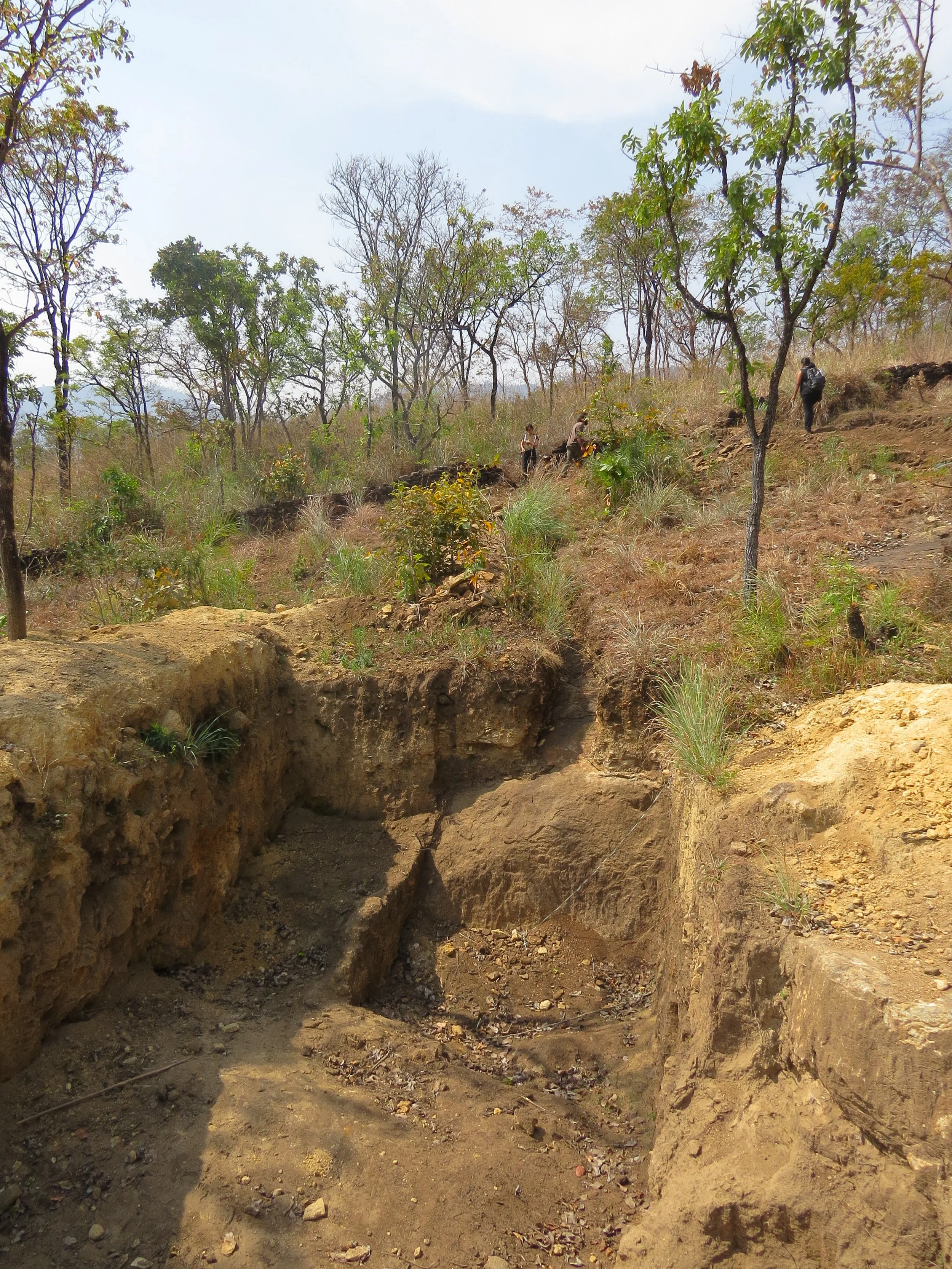
Site during the dry season
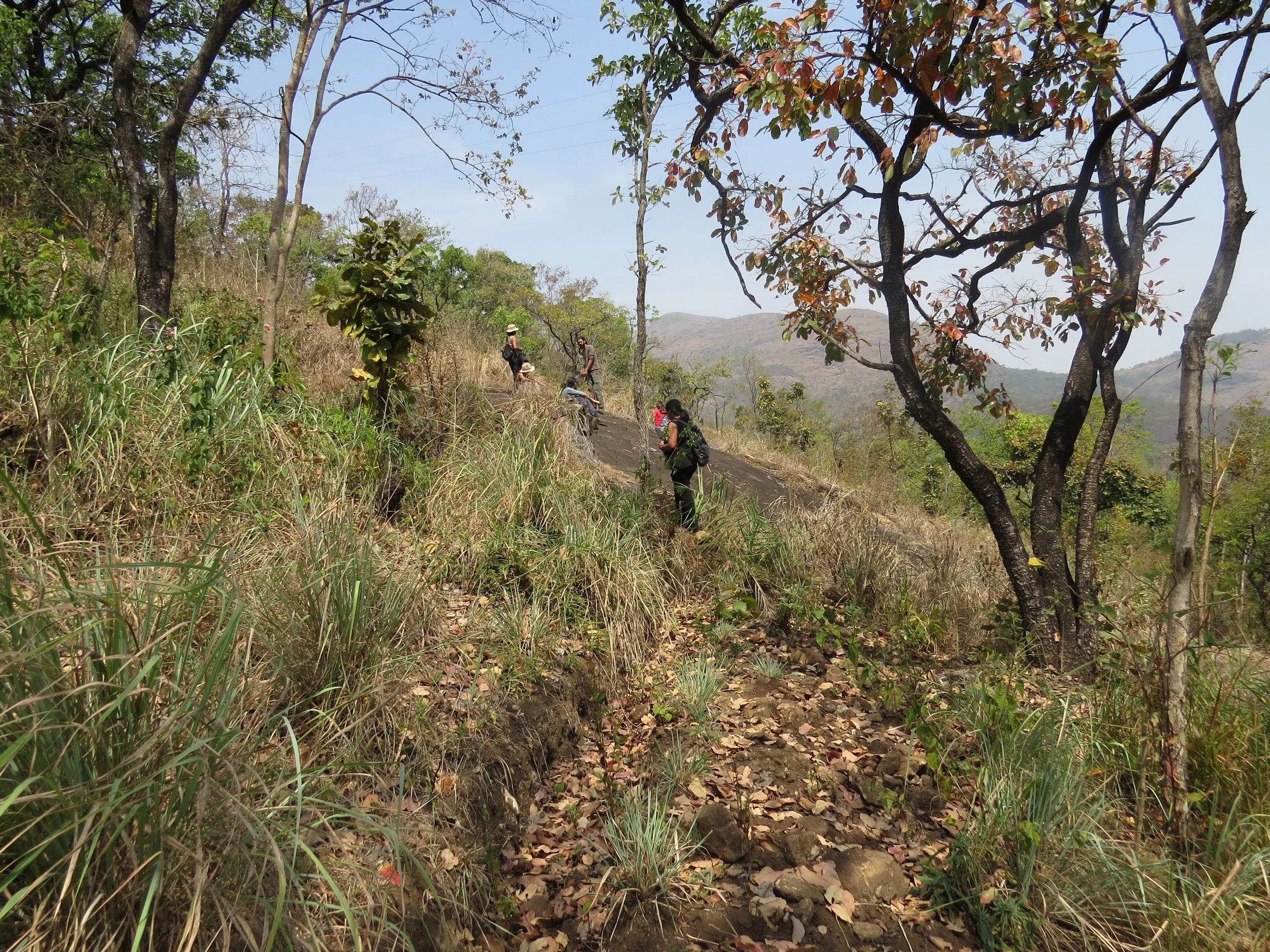
Higher areas of site, with sparse vegetation, grasses and rocky slopes
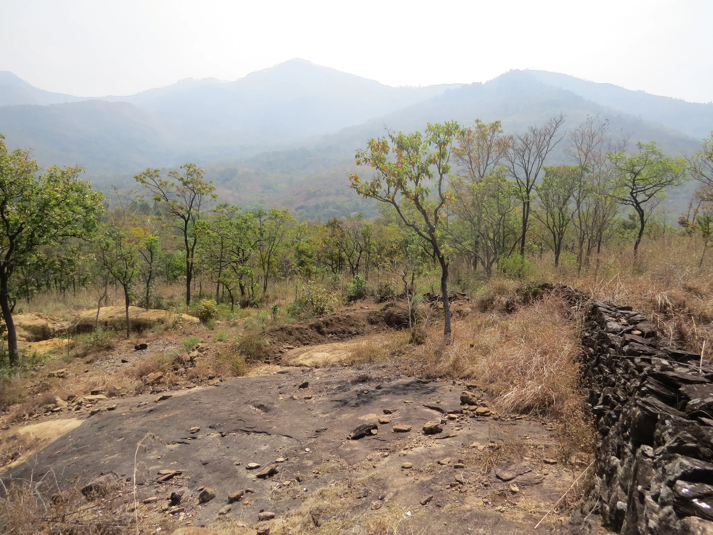
Paarai (rocky slope) with a dry masonry bund to slow water and recharge a spring
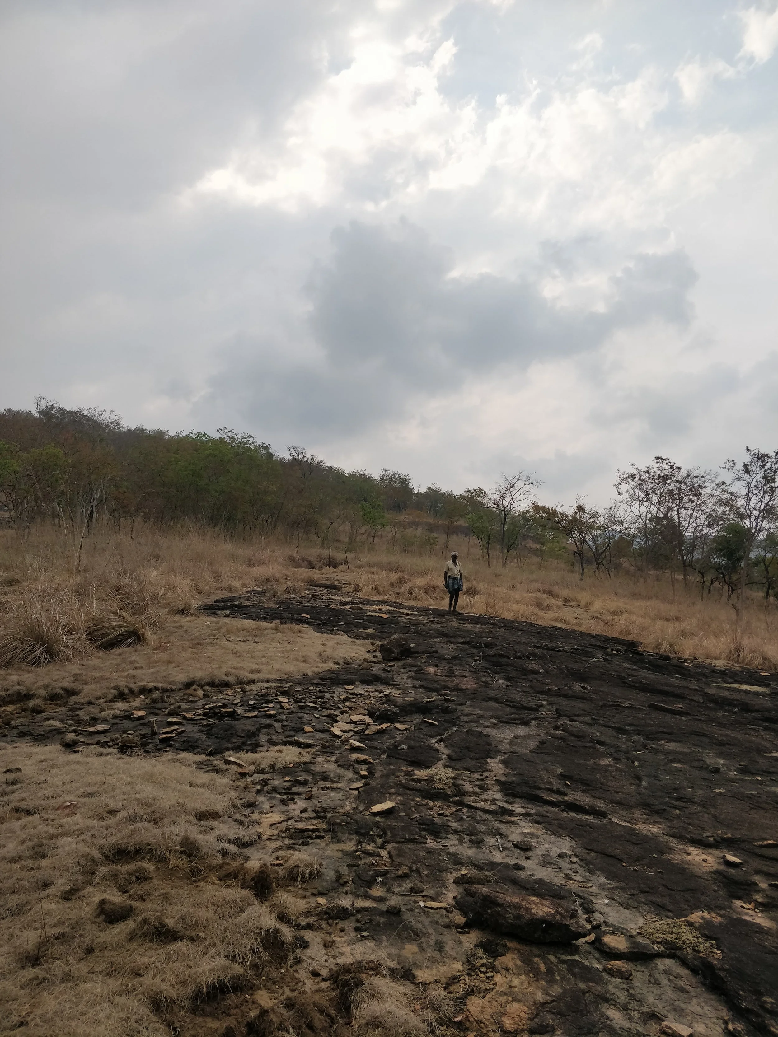
Paarai
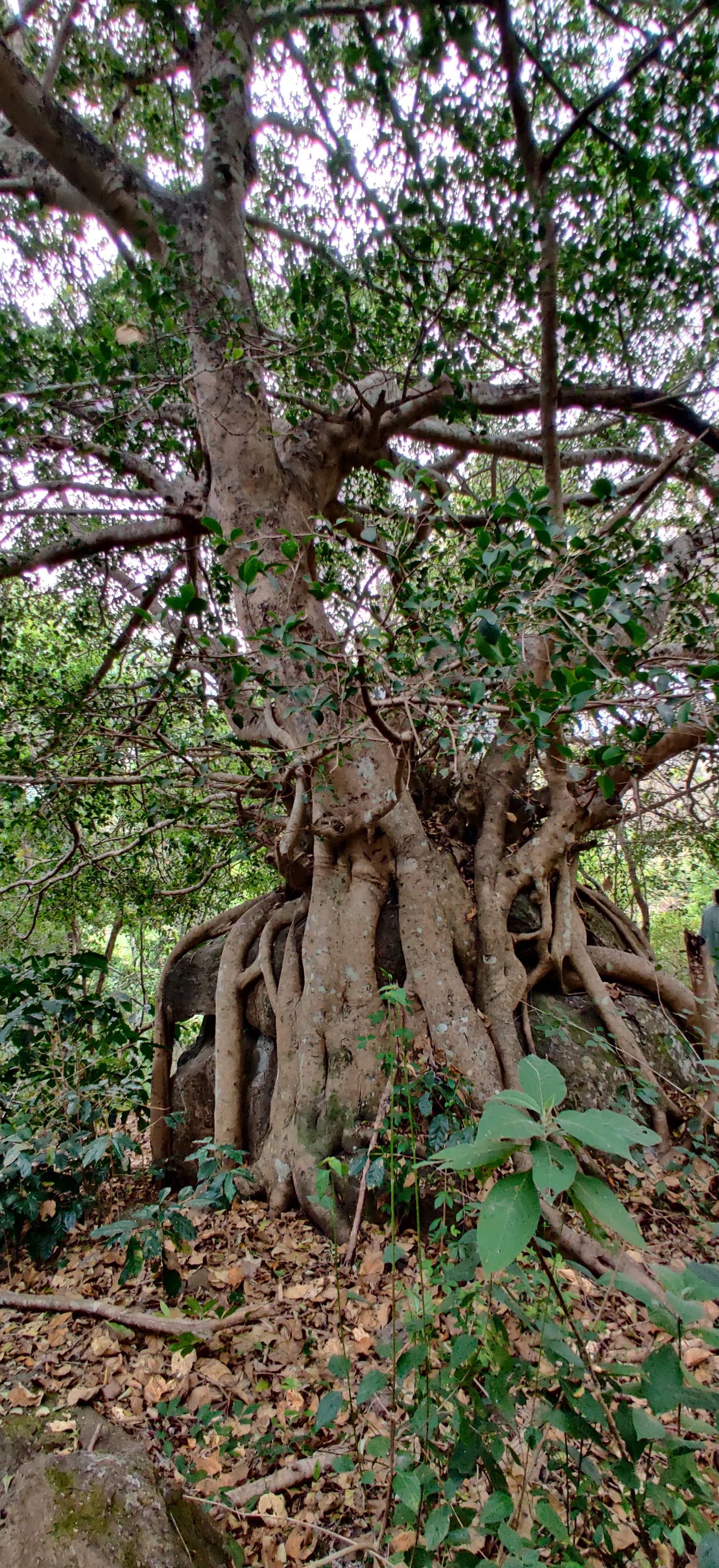
Old Ficus on a boulder
Spring-fed pond

Spring in the forest - main existing source of water for the land
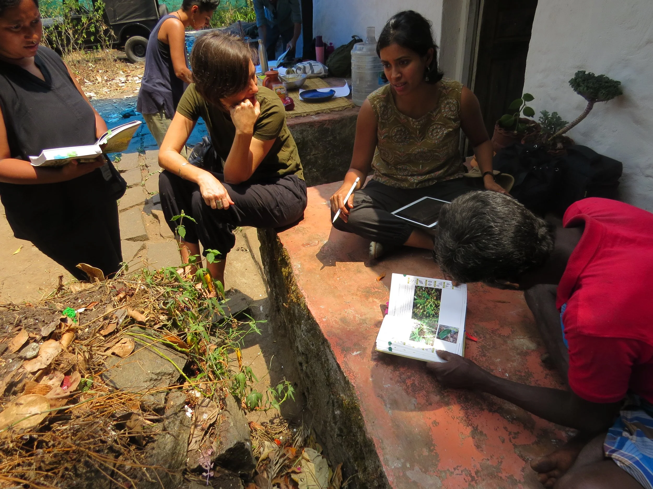
Learning about the site's native species from the community
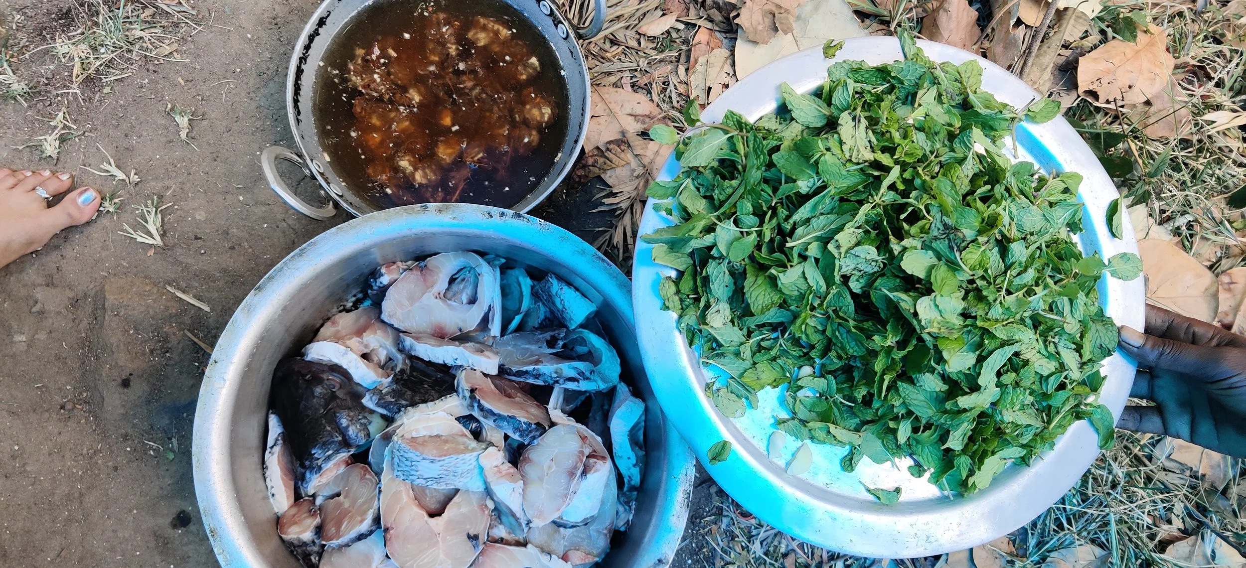
Community lunch
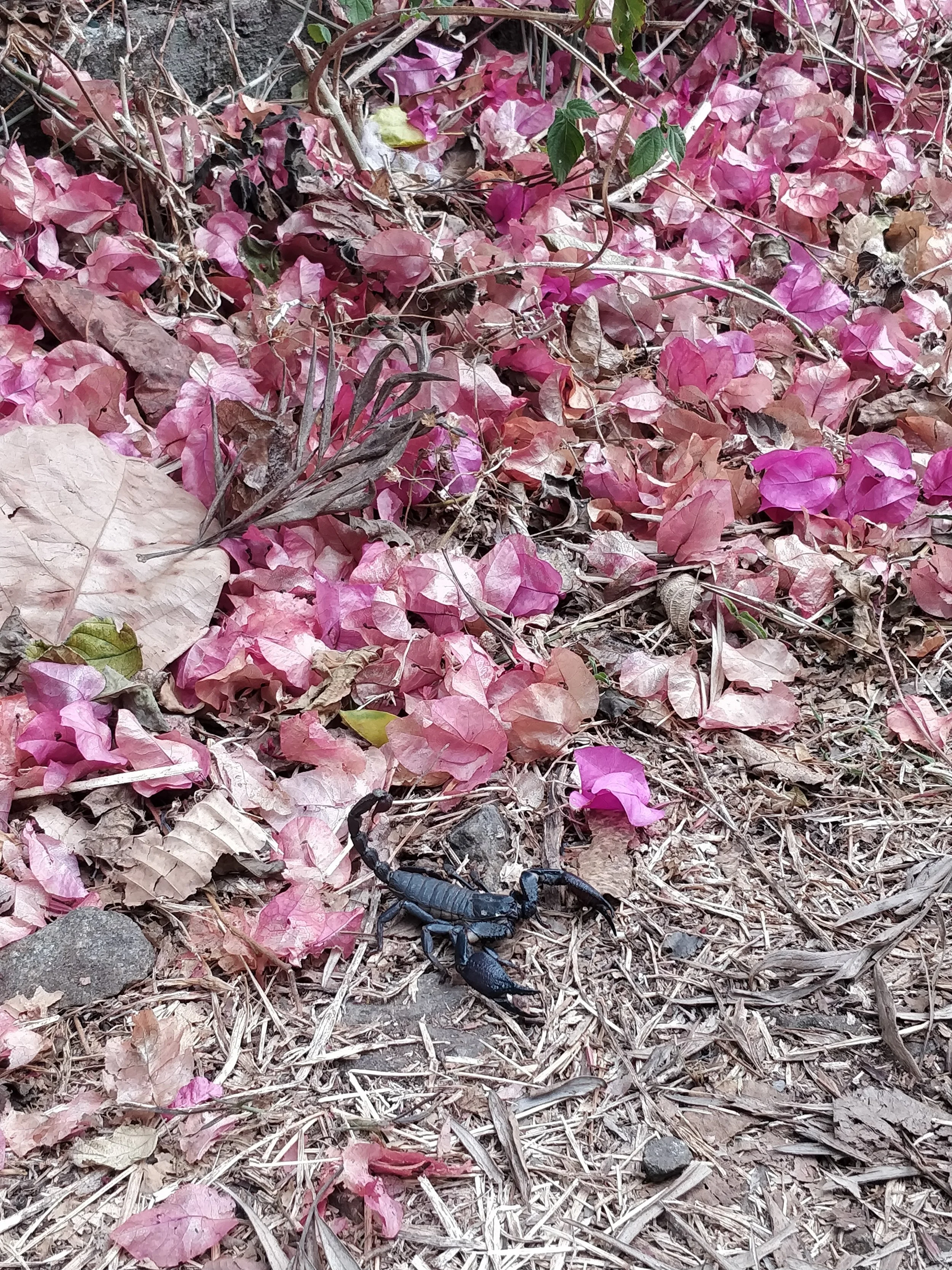
Black forest scorpion
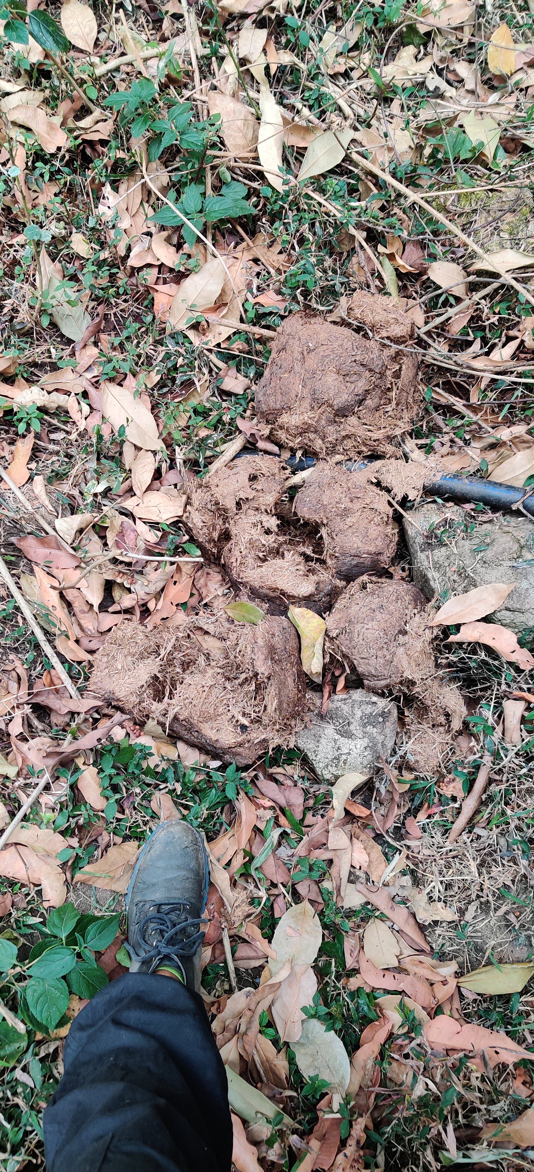
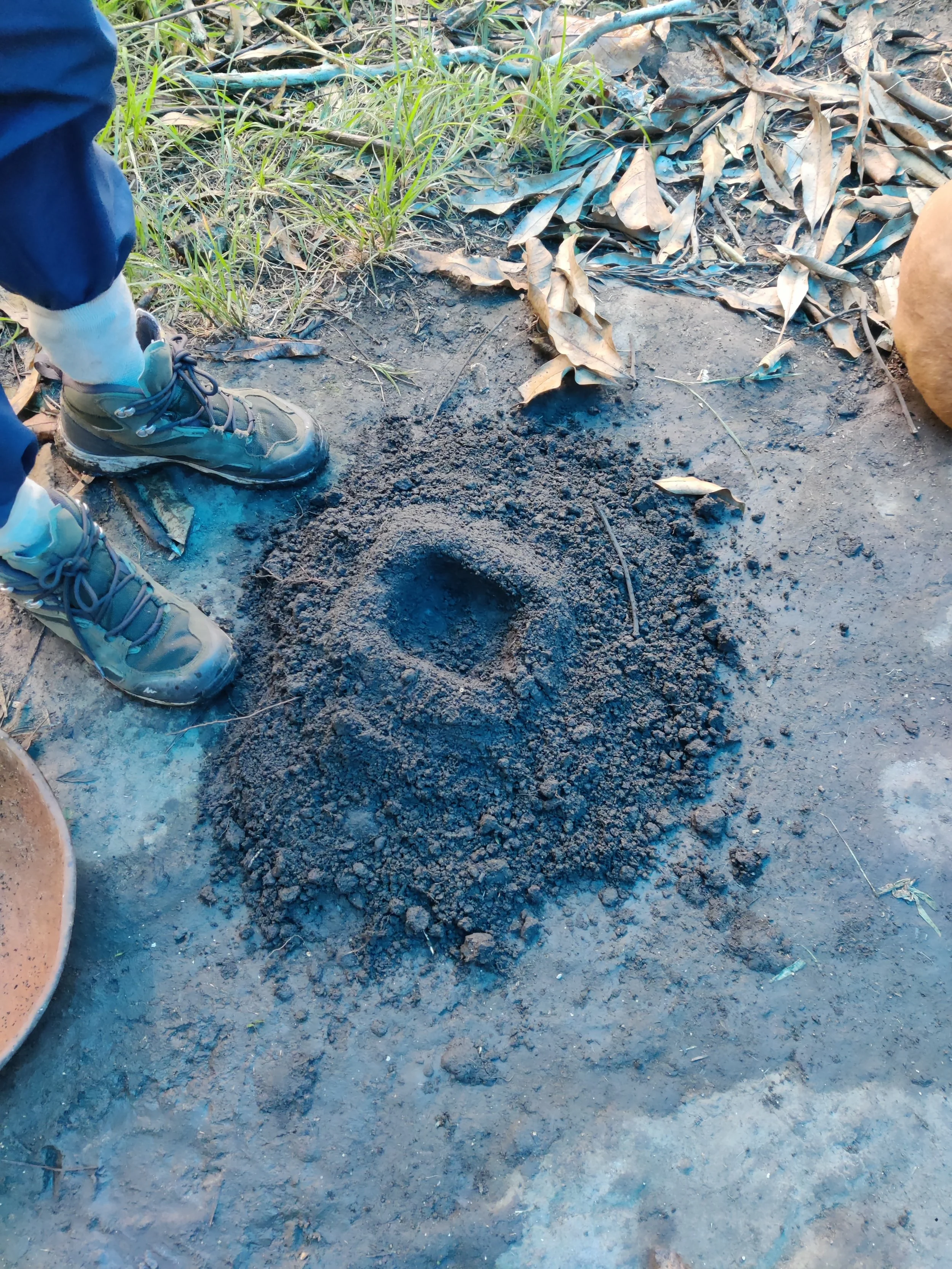
Elephant dung
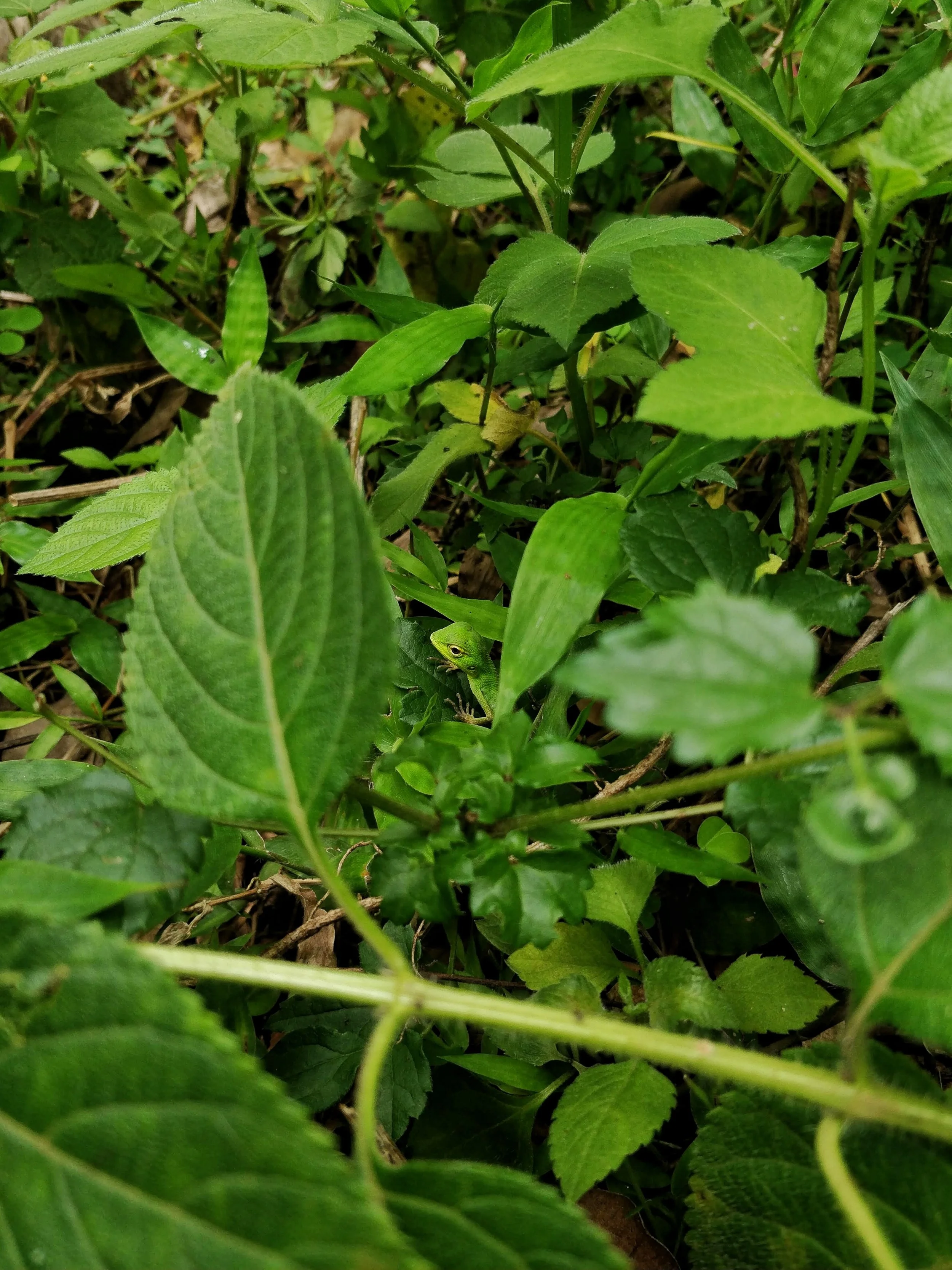
Green forest lizard
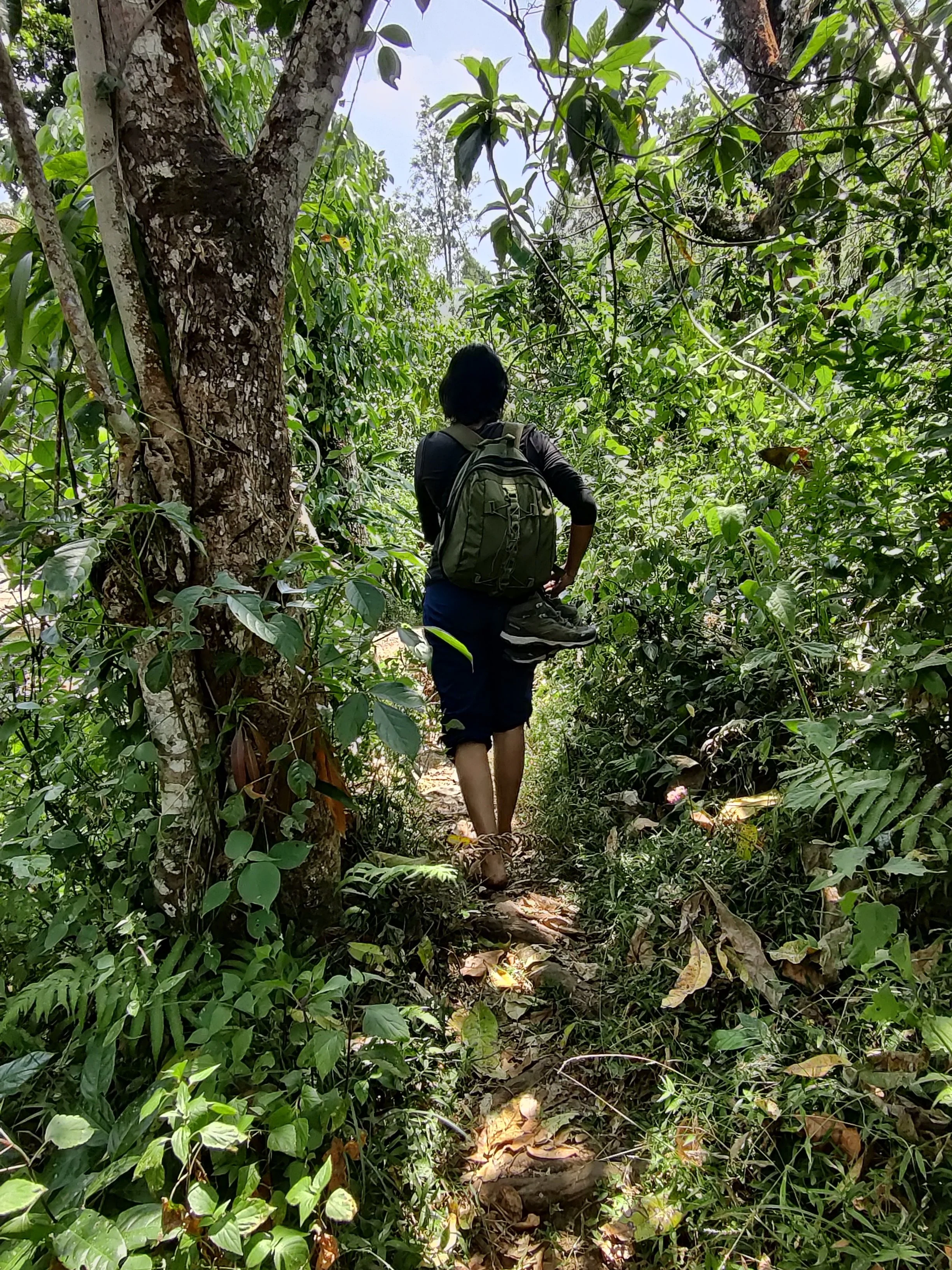
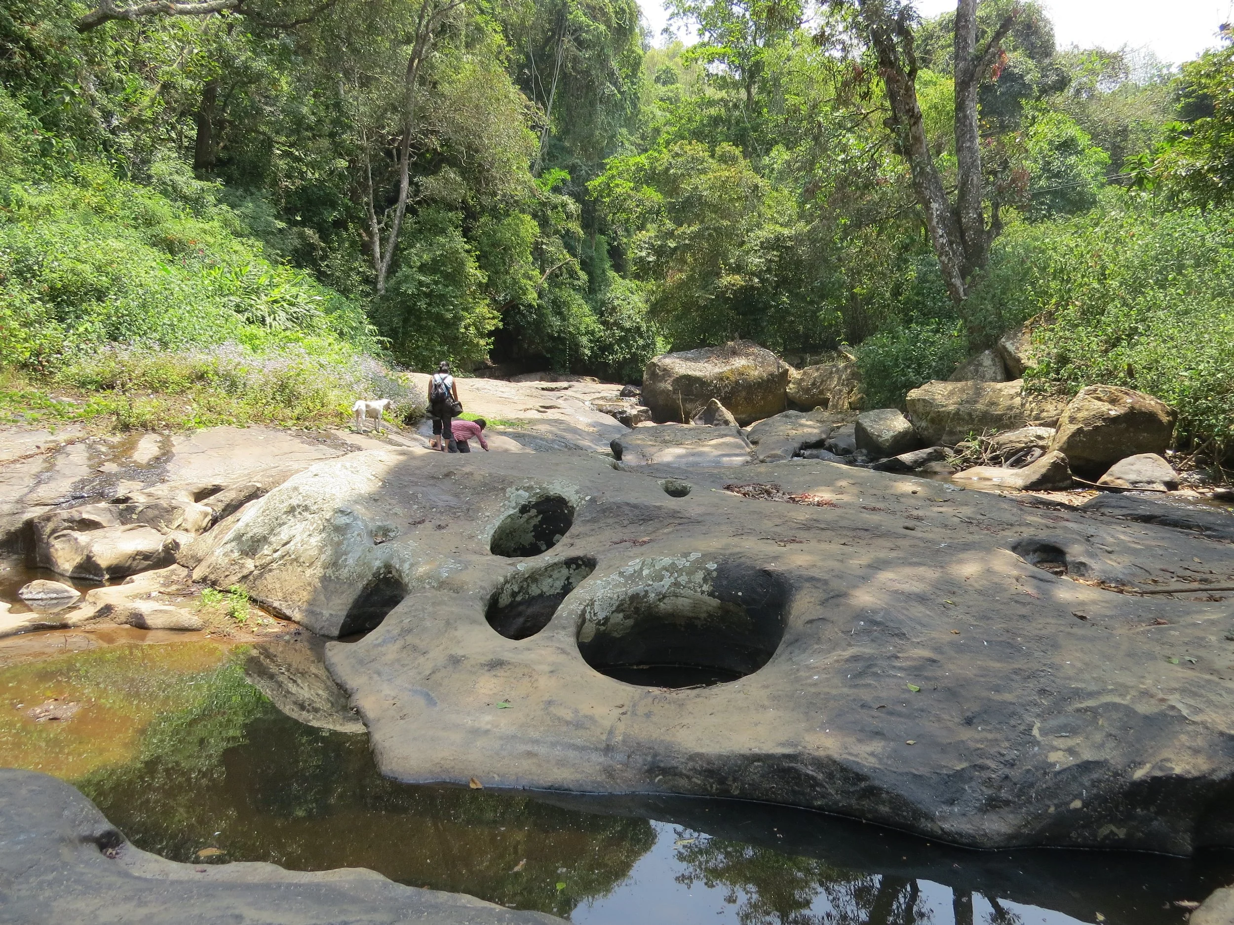
Exploring the riparian zones around the site
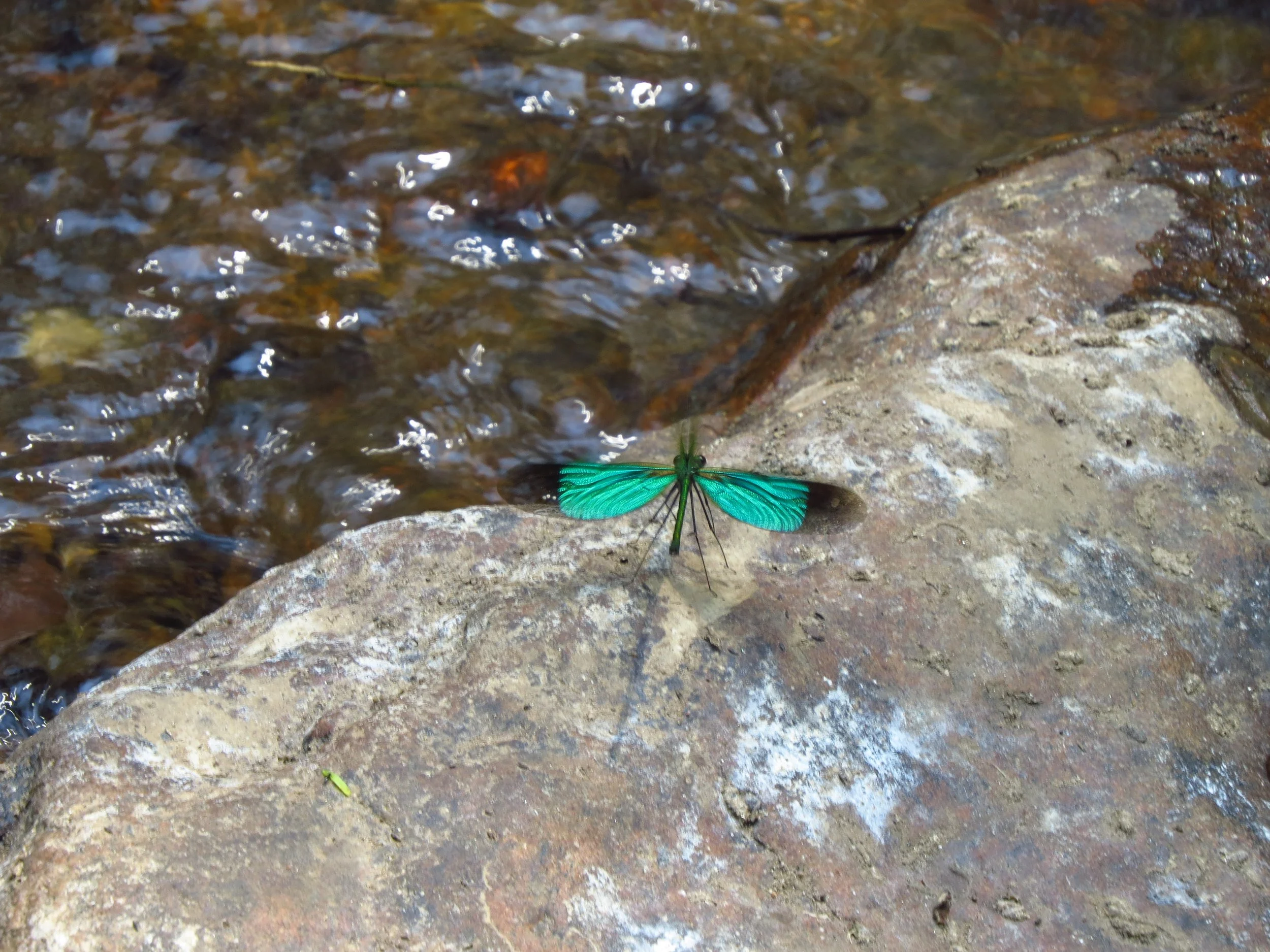
Stream glory damselfly
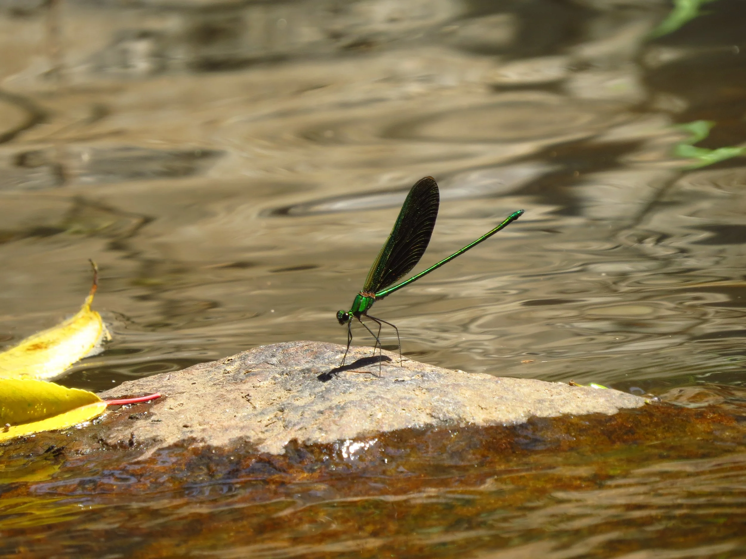
Stream glory damselfly
Stream near site
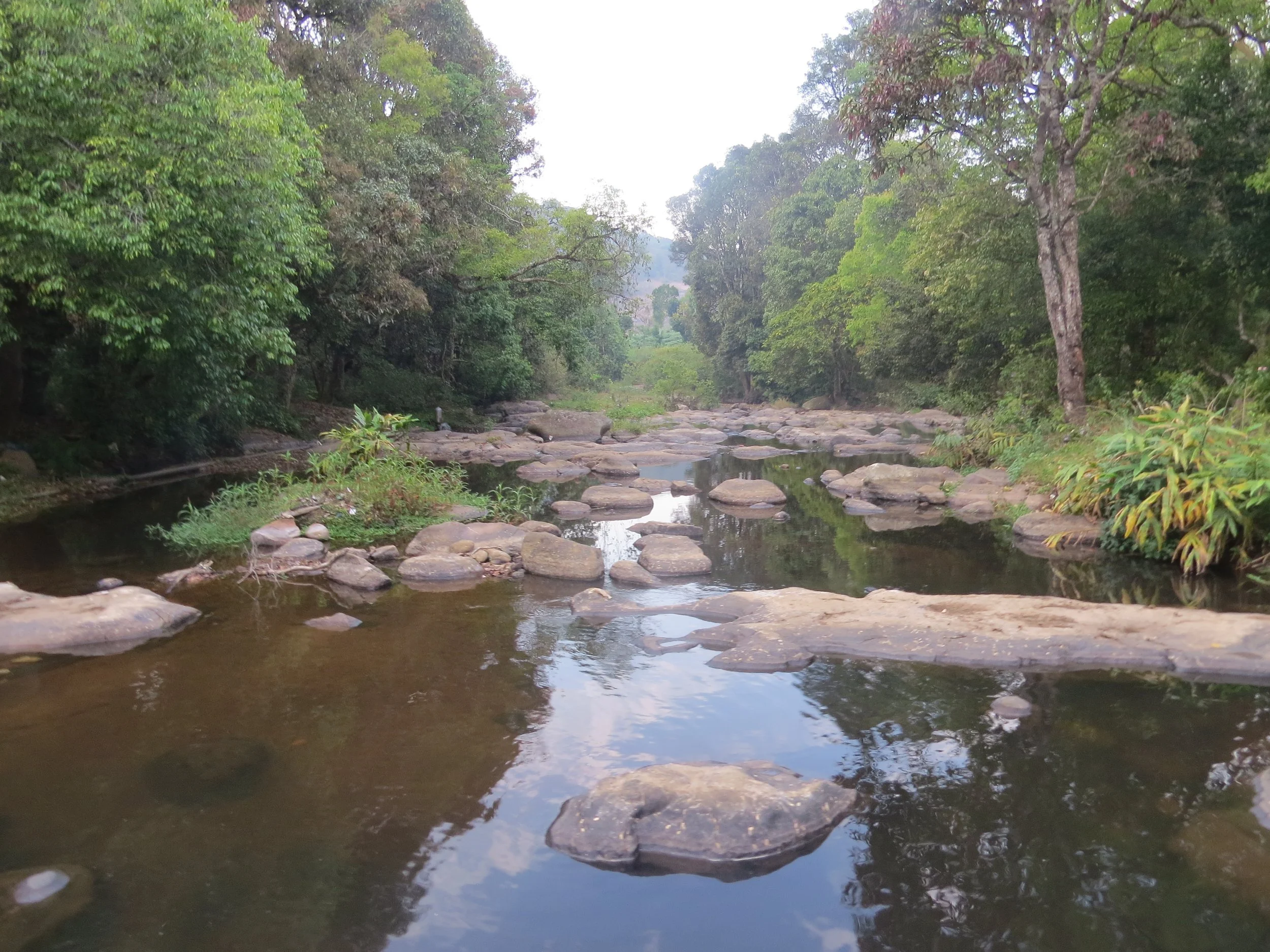
Palar river
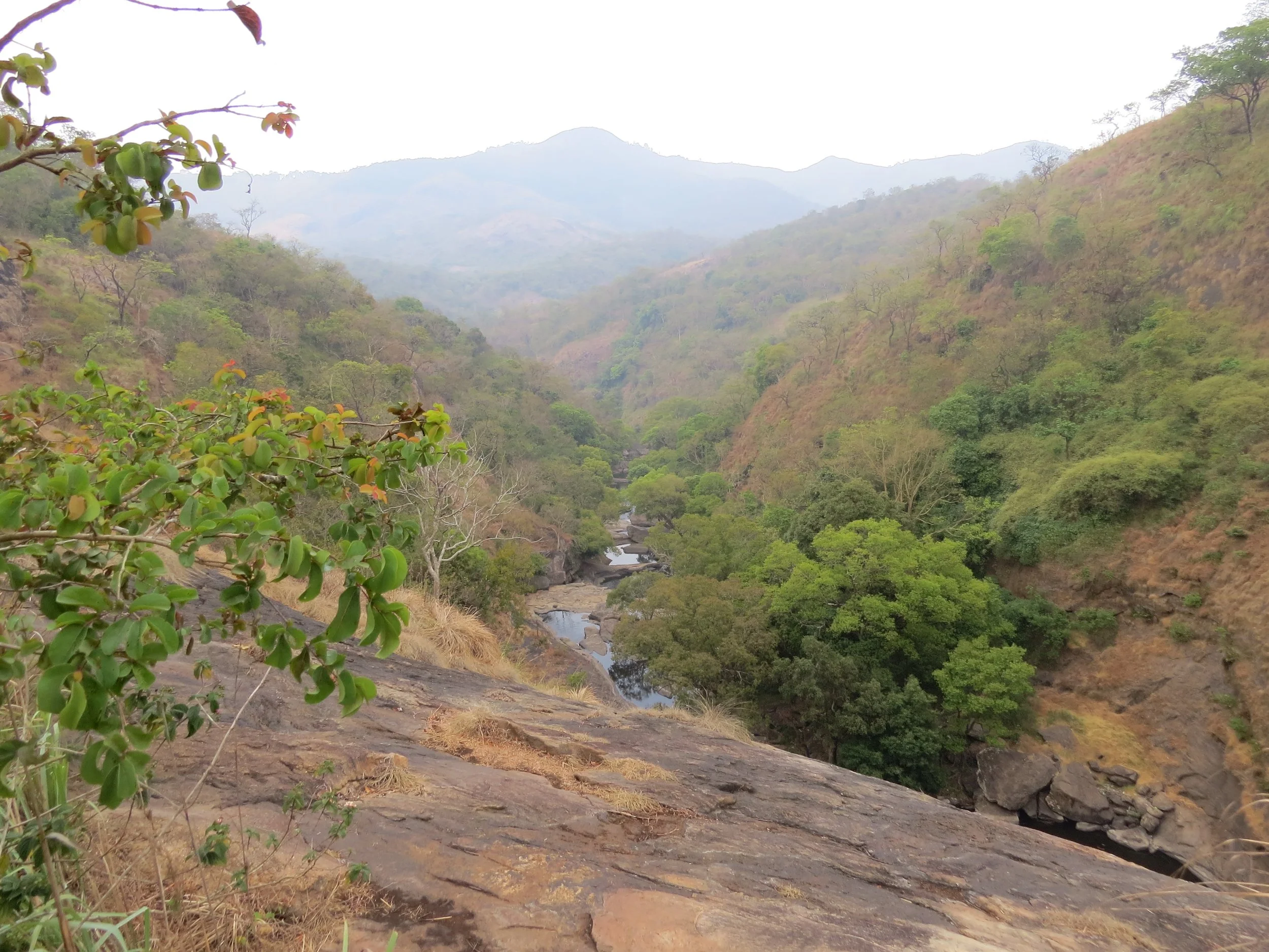
Palar river, further down the valley
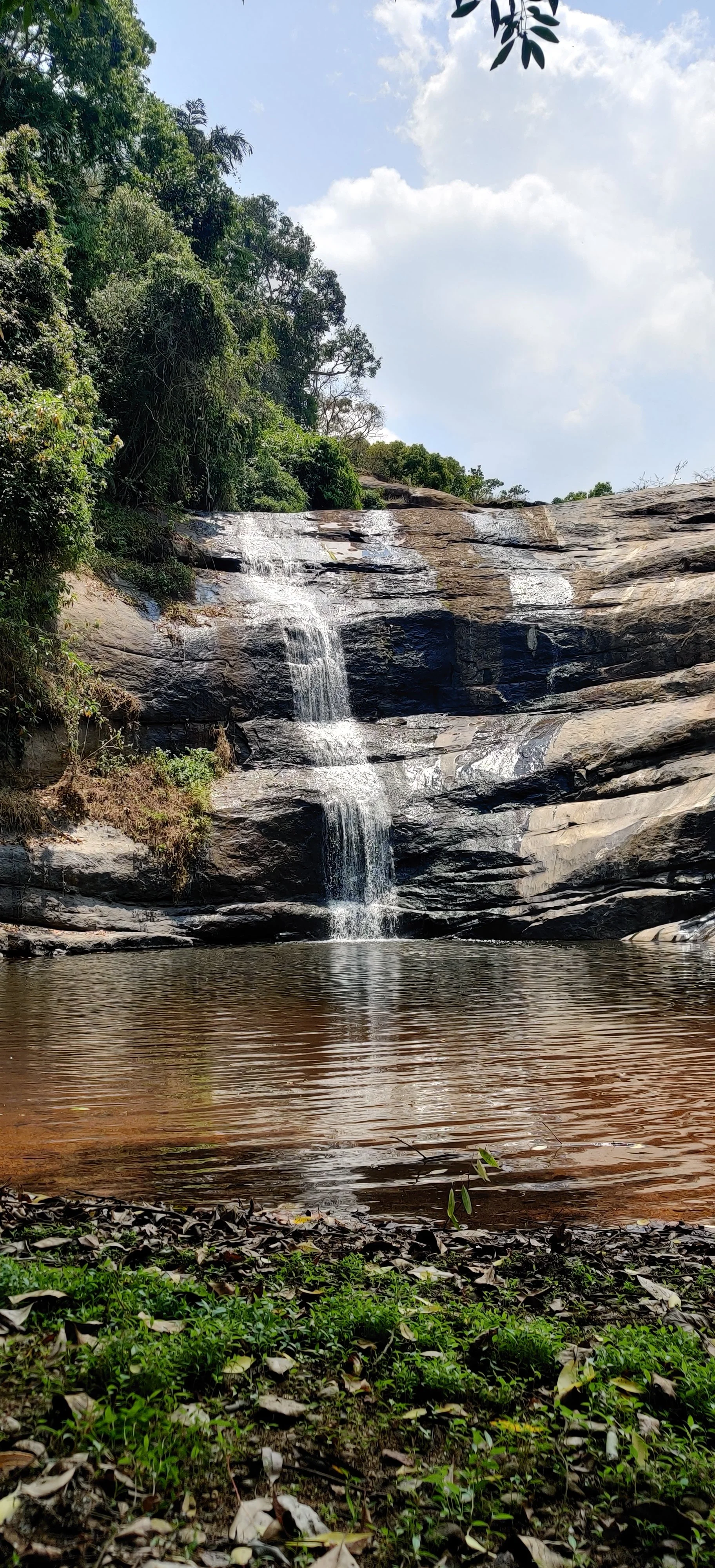
Local waterfall
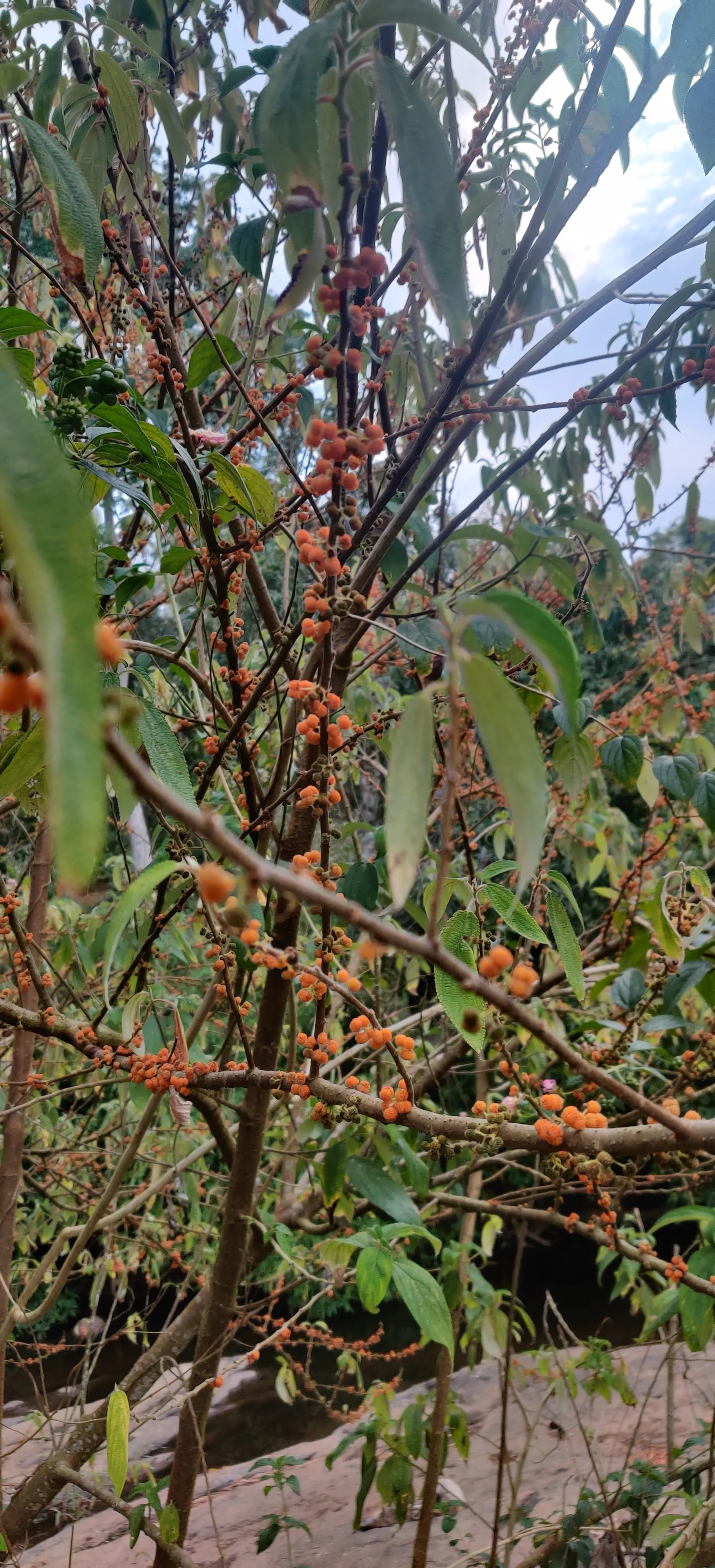
Yellow/orange raspberry
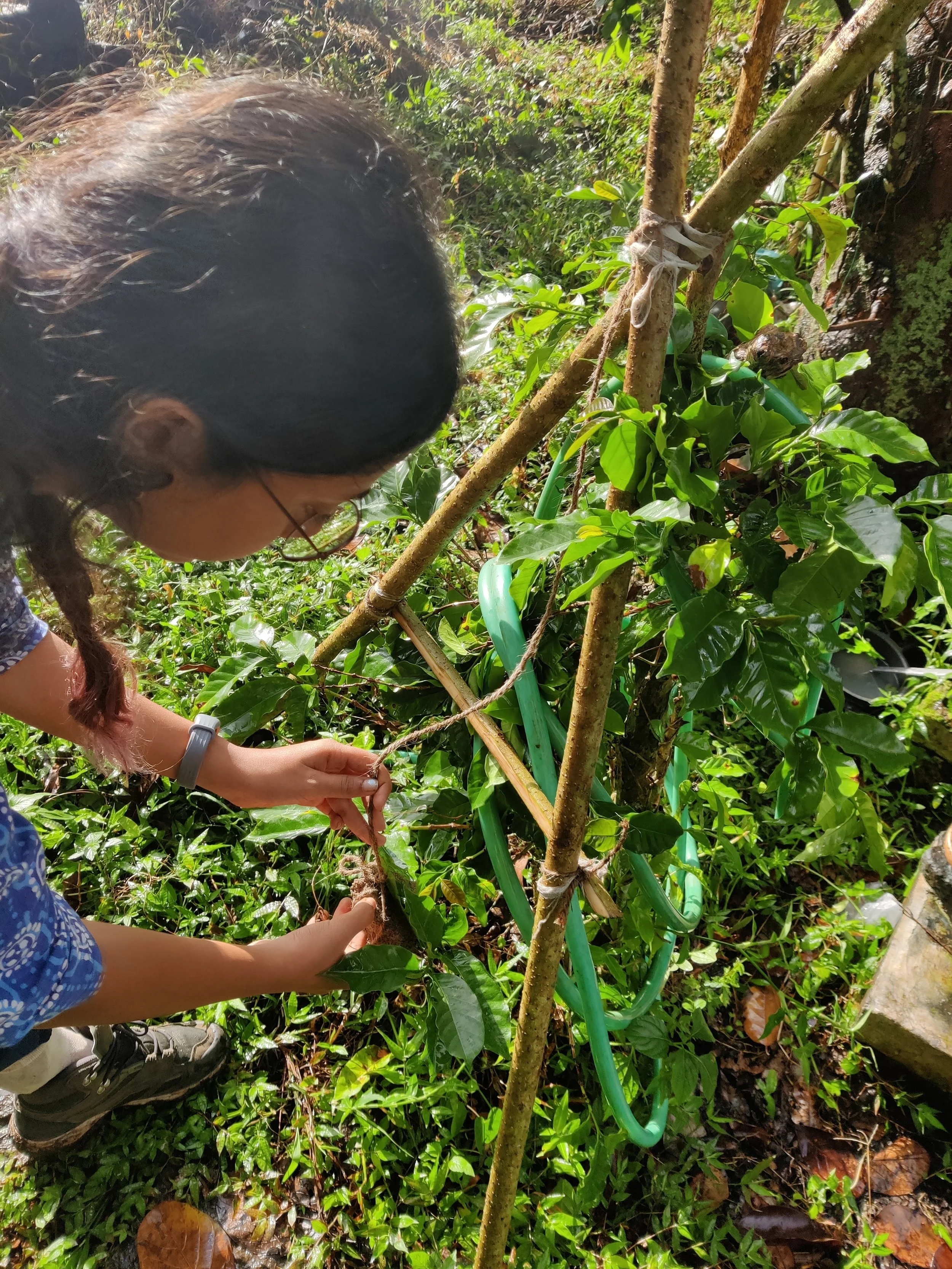
Making an A-frame to mark on-contour trenches on site
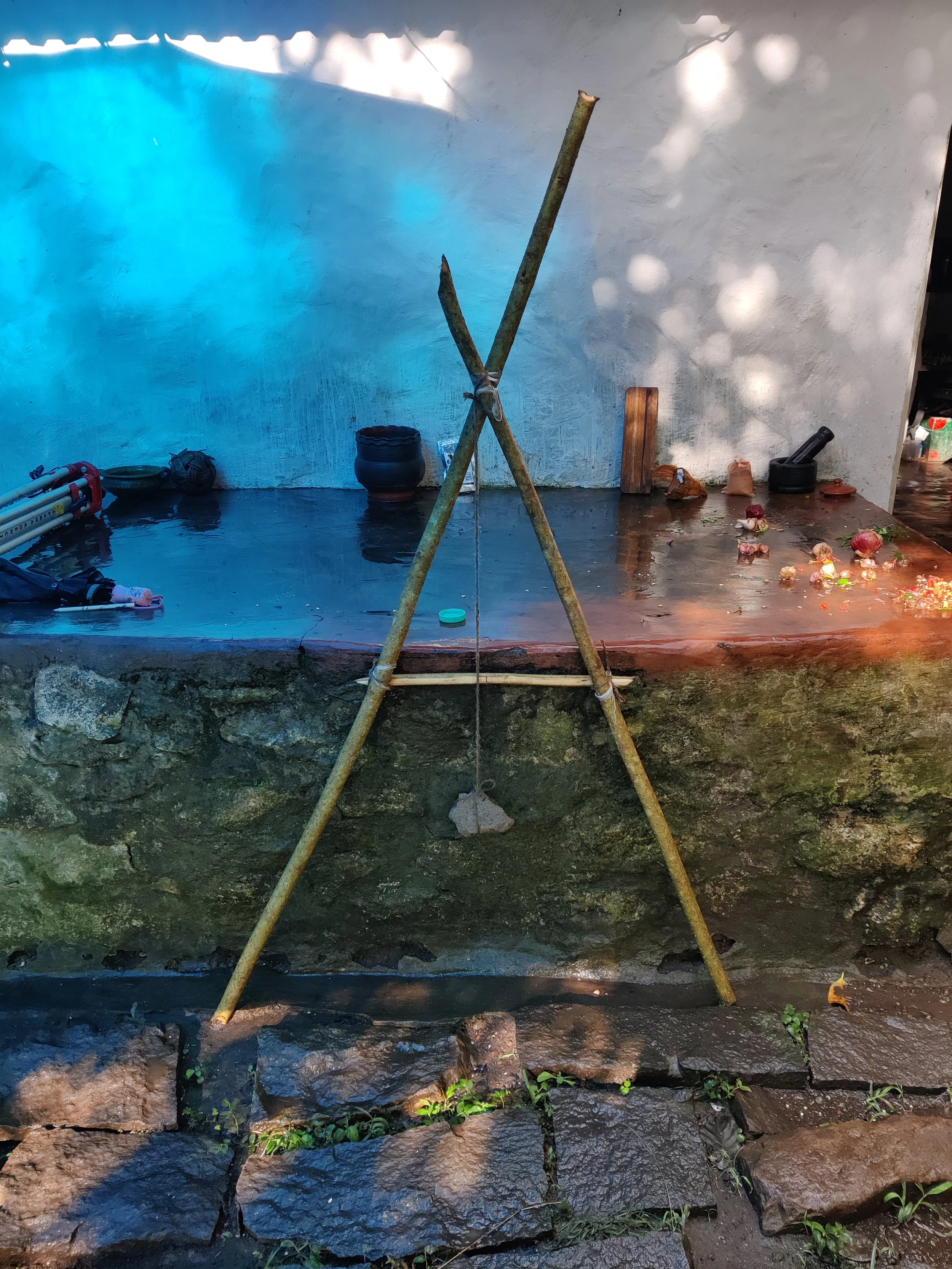
A-frame
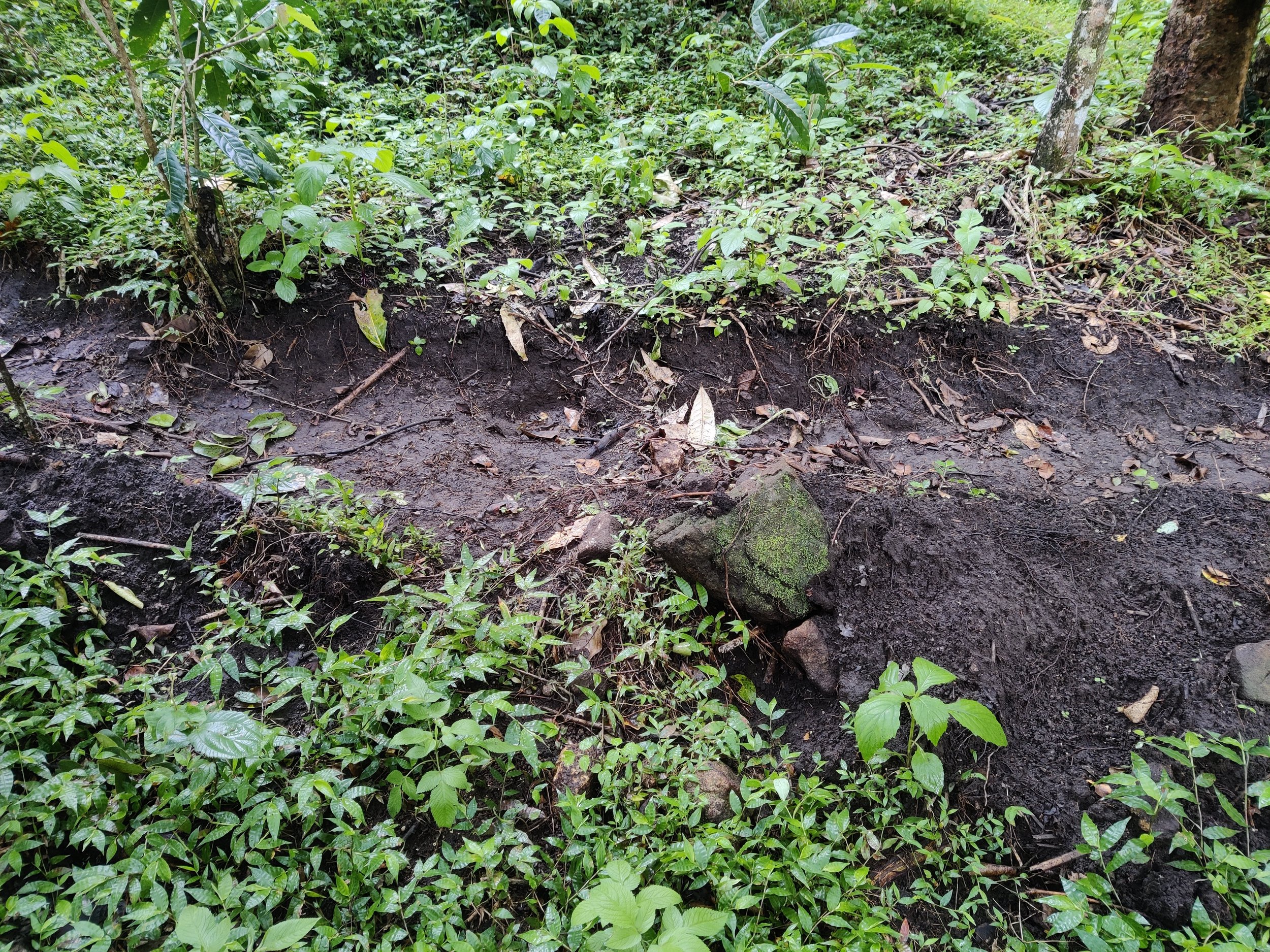
Trenches on site connecting ponds and basins
Pond design discussion using mud models
Architectural Design
As part of the larger masterplan, three built structures were developed: a residence, an artist residency studio (attached to the residence), and a community centre accommodating spaces for gathering, storage, display, sale, and processing. The architectural design of the three structures was co-led by Sanjana and Theertha before being handed over to a vernacular architecture expert for construction.
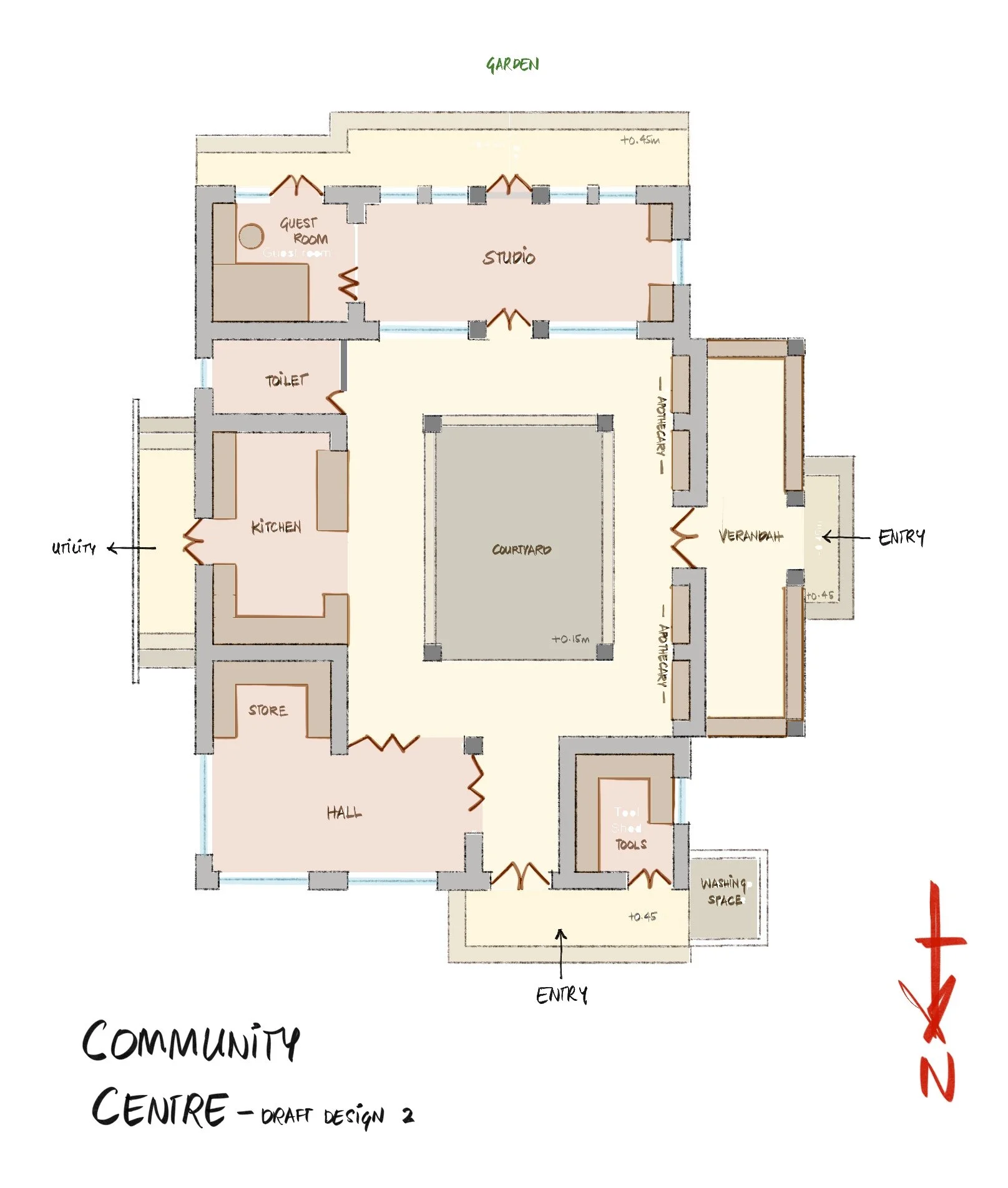
Community Centre Design
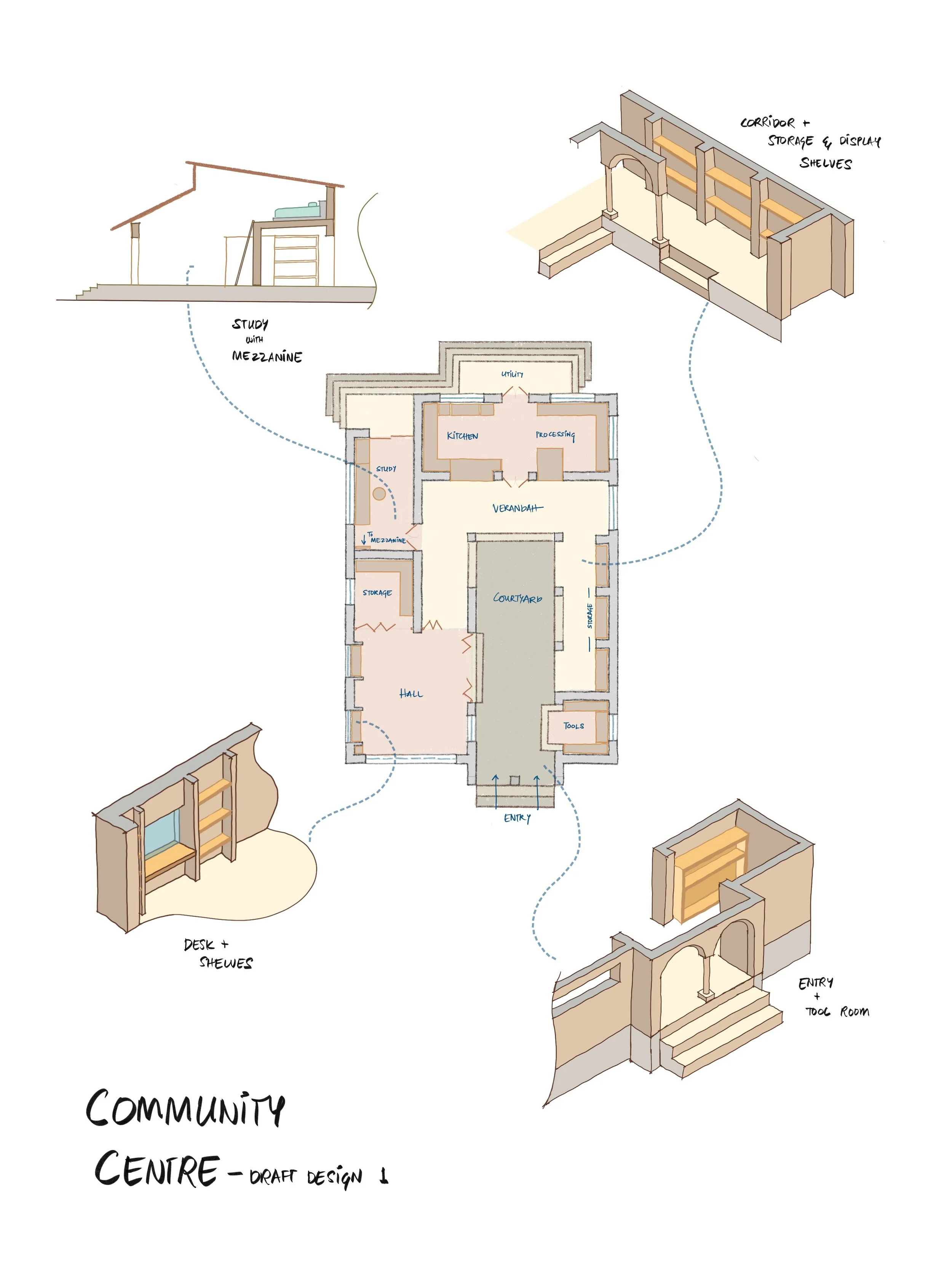
Draft layout
Final layout
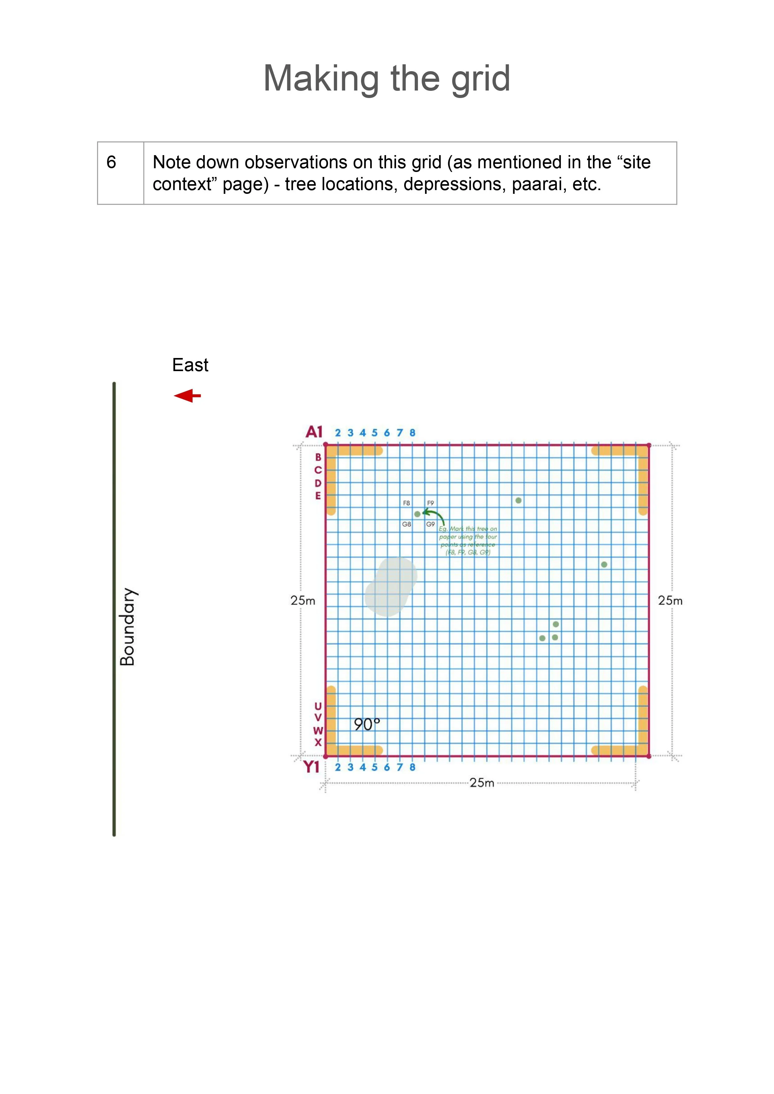
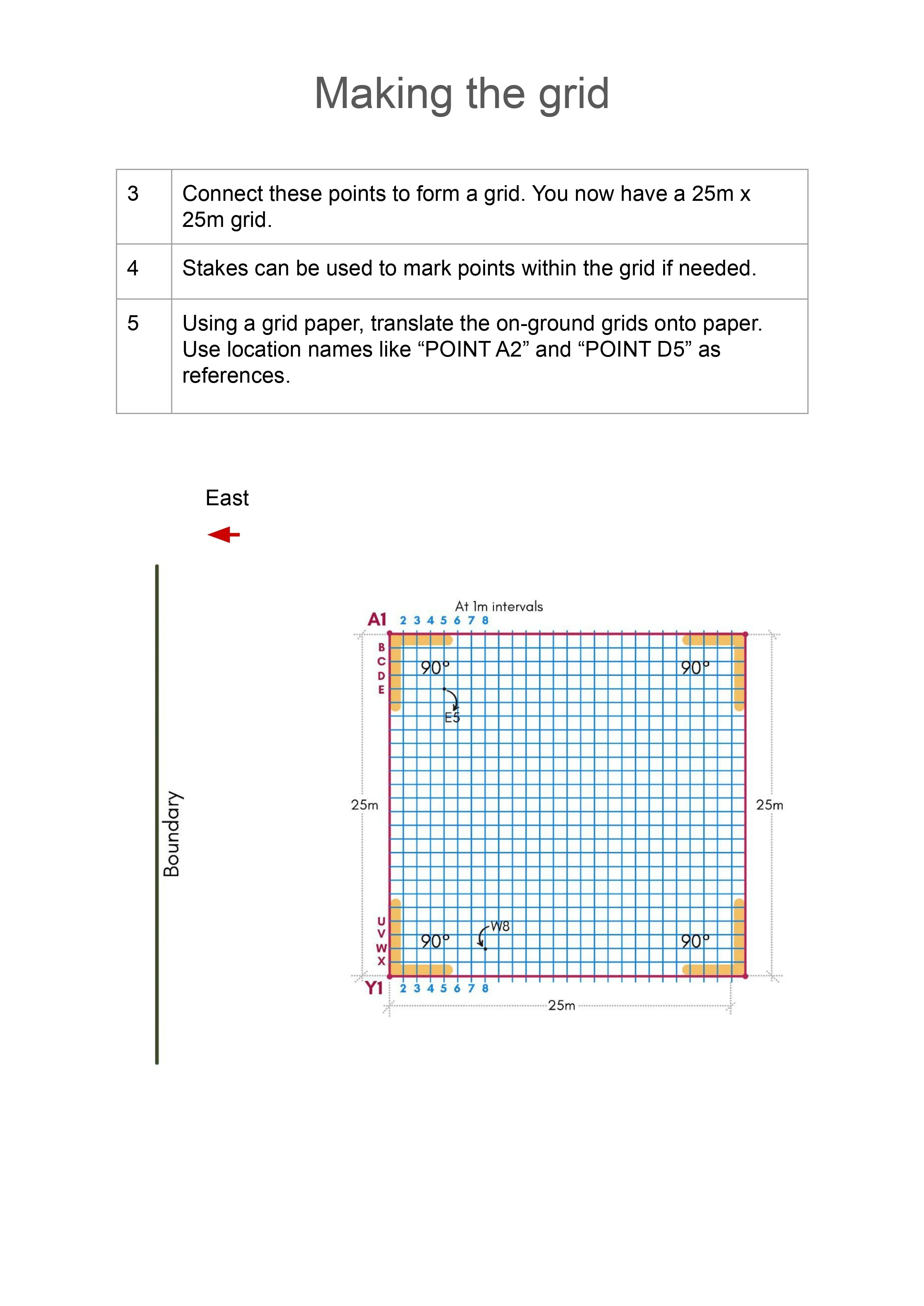
Design for home and studio: site survey
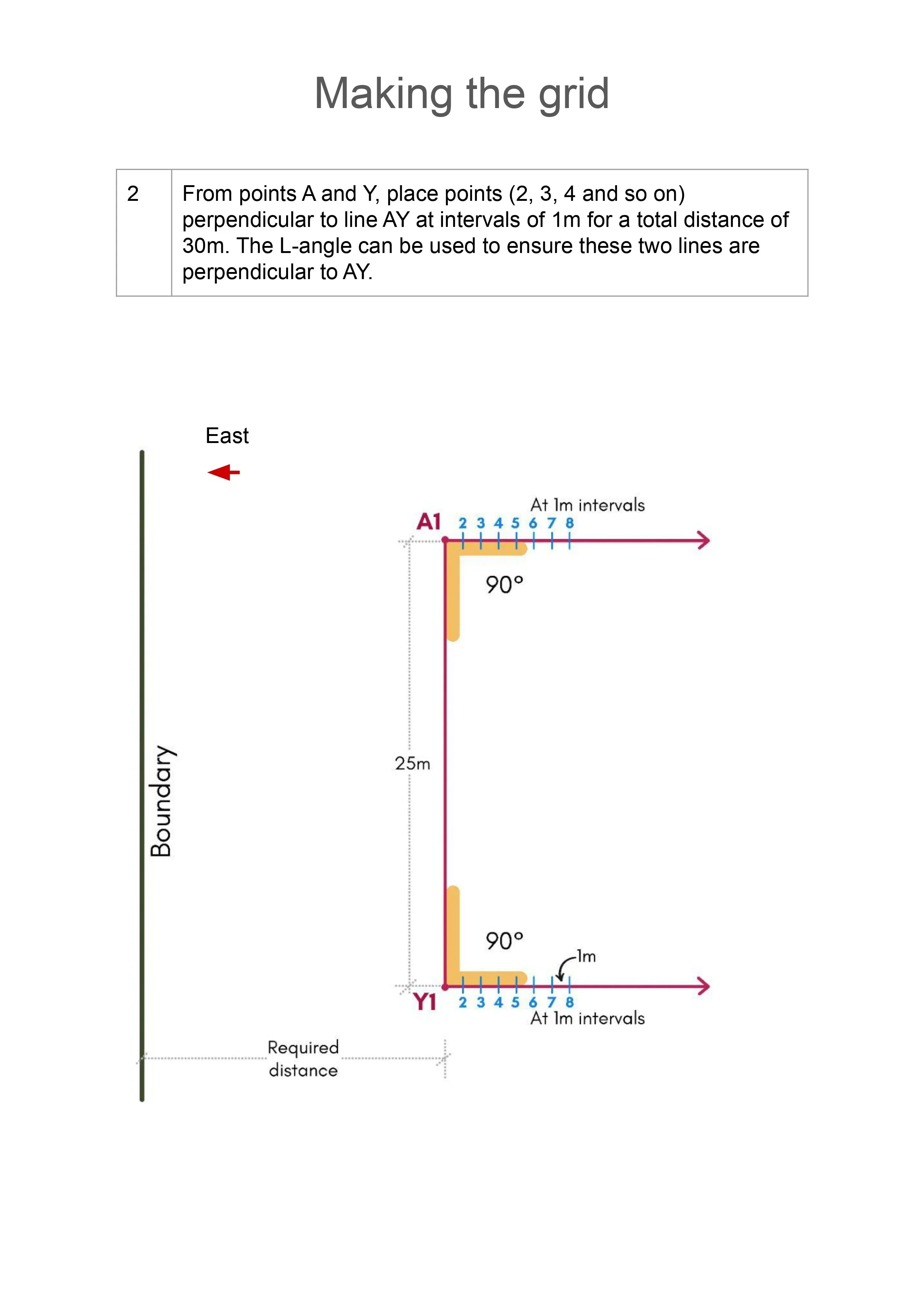
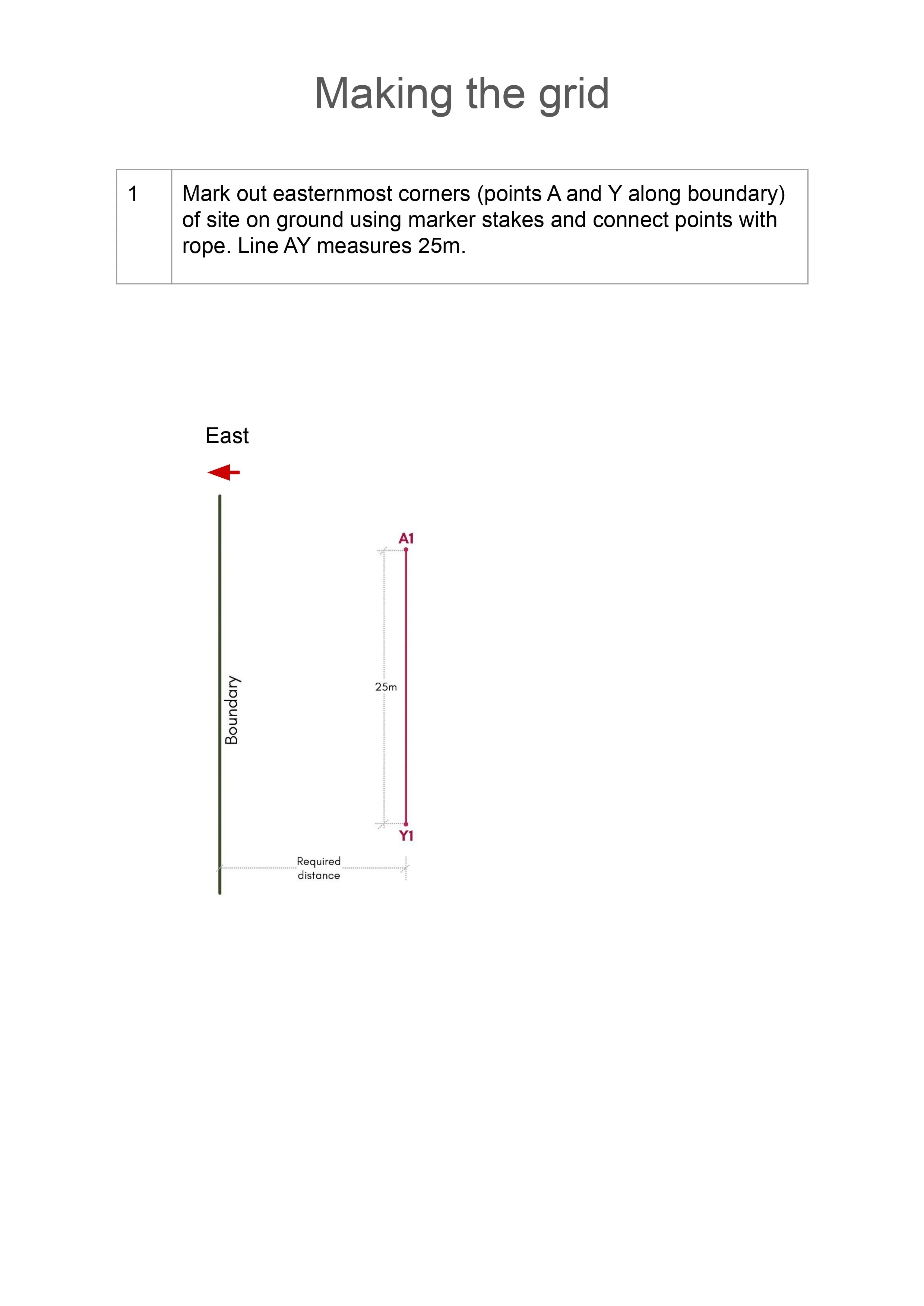
The design process began with identifying a suitable location within the 3-acre site, guided by ecological, spatial, and functional considerations. Steep gradients and dense forest cover made a conventional topographic survey challenging. Instead, the team remotely coordinated a bunyip survey carried out by the clients to determine elevation levels.
The data from this survey, combined with the mapping of existing trees, established accurate contours for the selected zone. This groundwork enabled the development of a detailed, context responsive design tailored closely to on-site conditions.
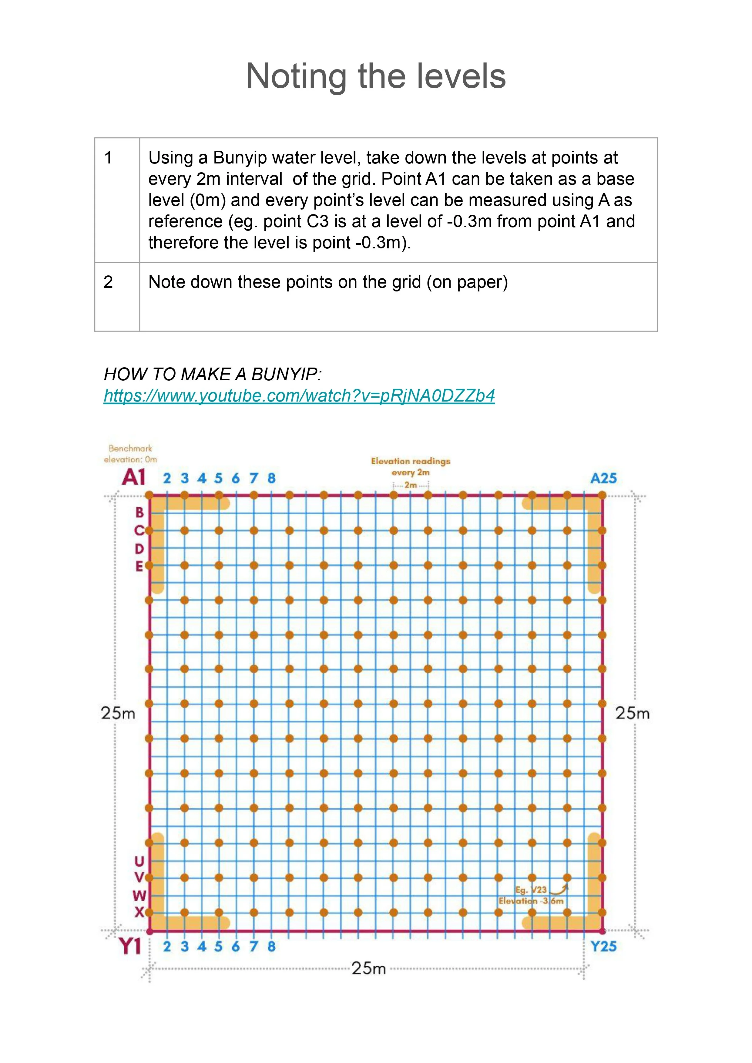
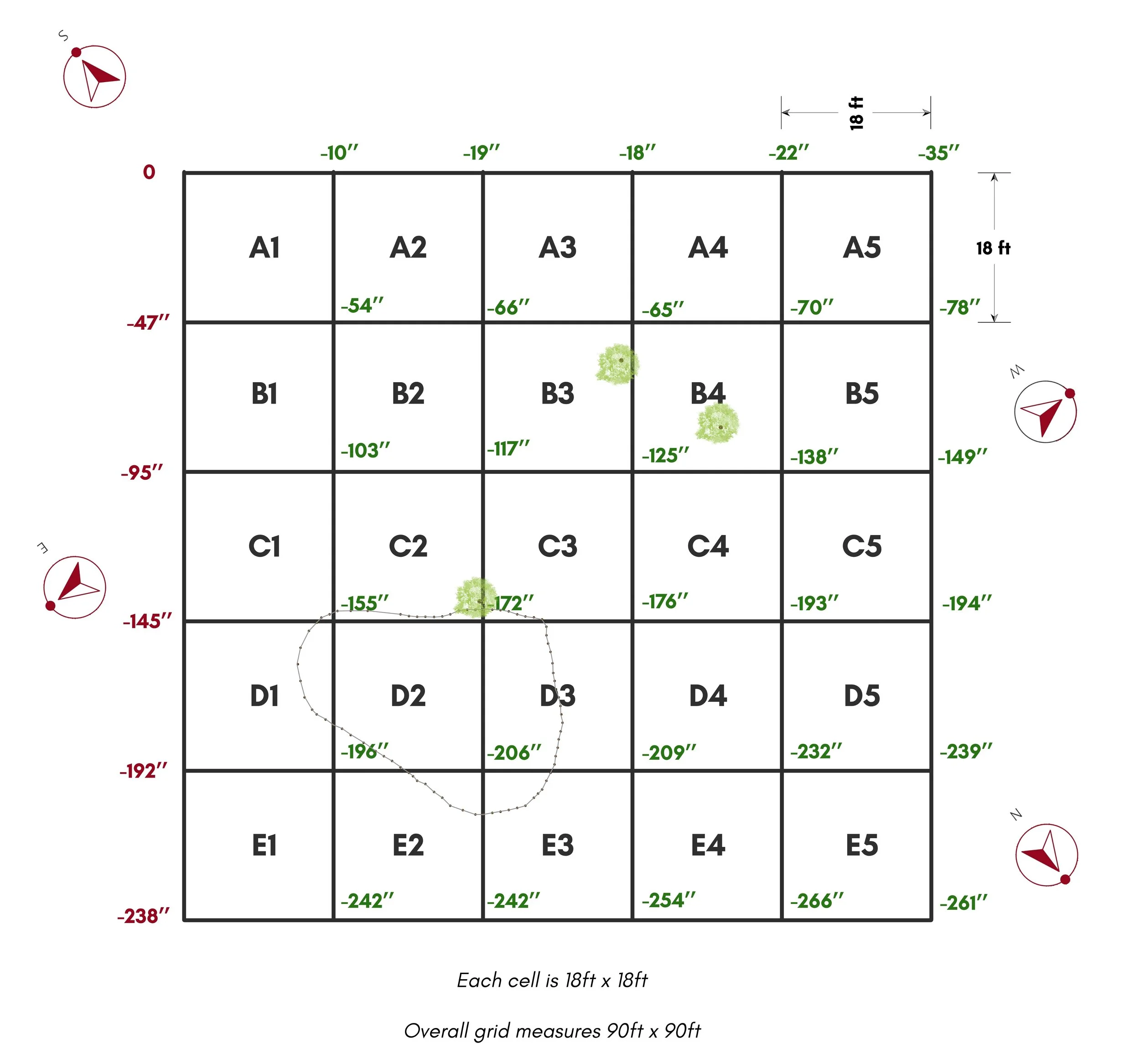
Remotely coordinated bunyip survey for the selected site
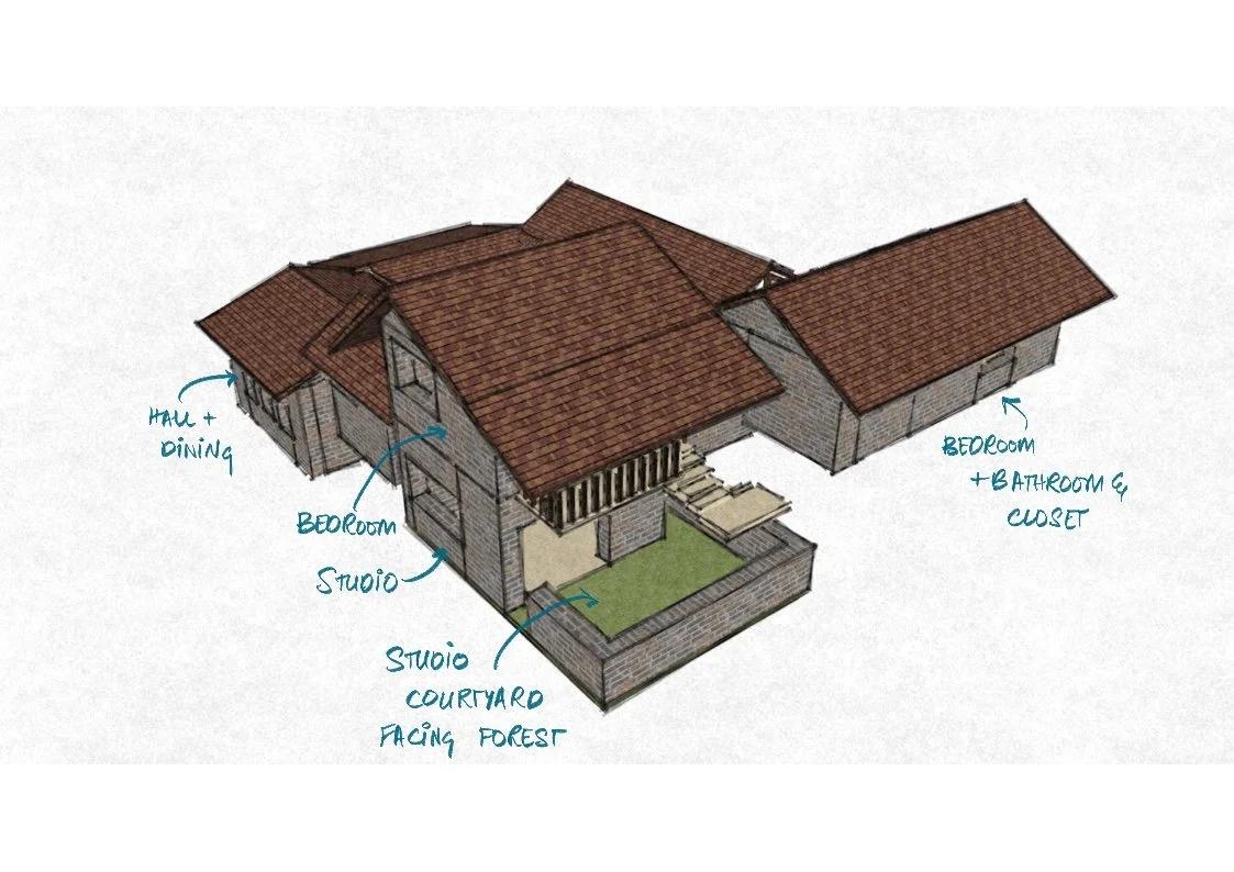
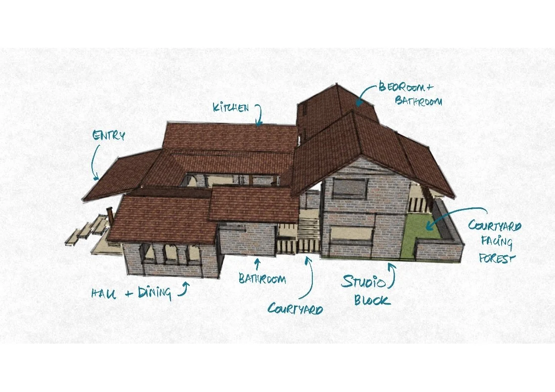
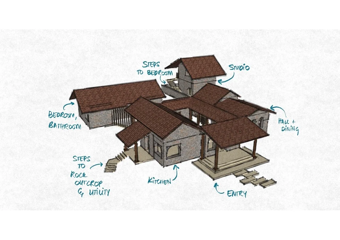
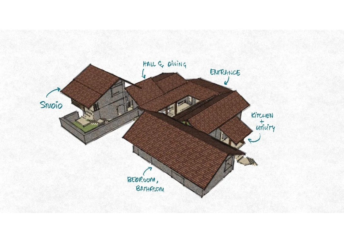
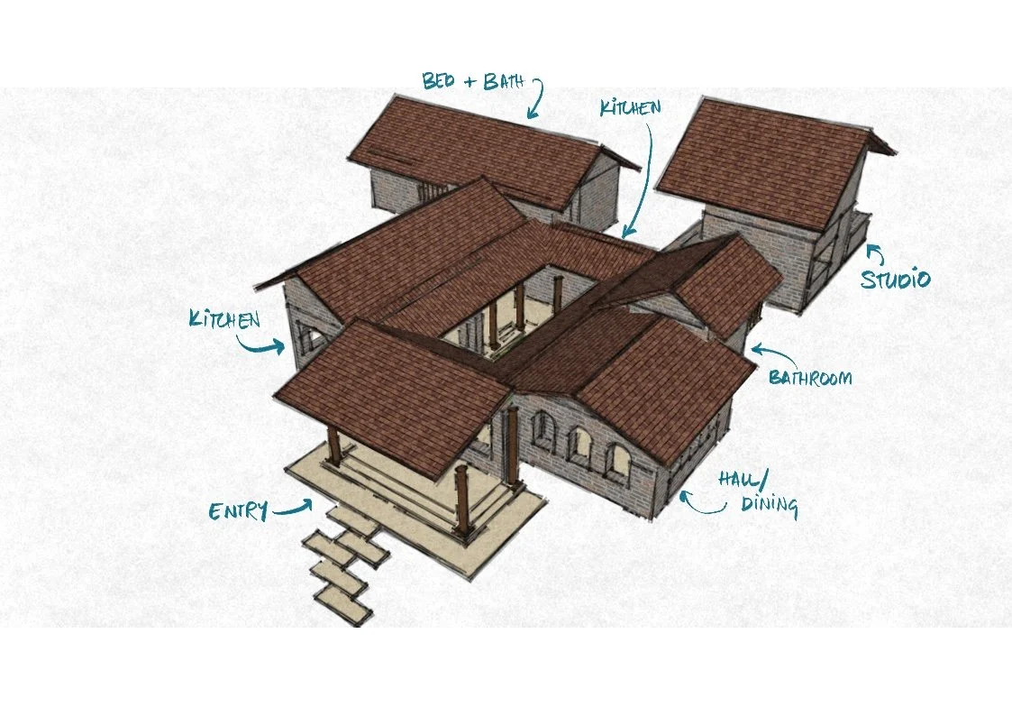
Home and studio design
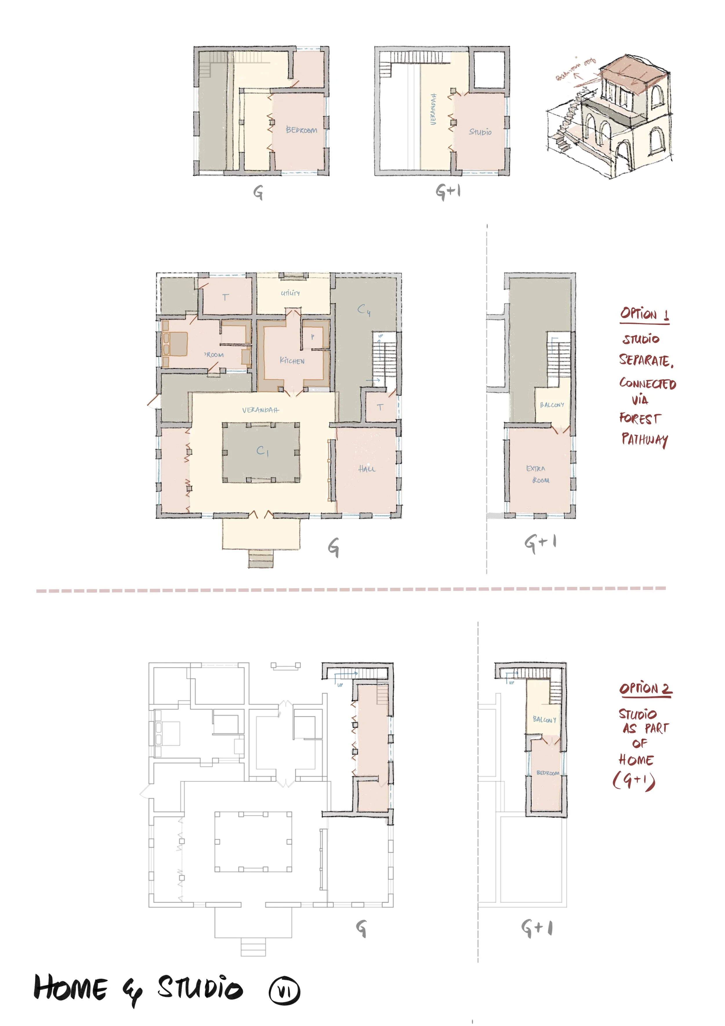
Draft layout 1
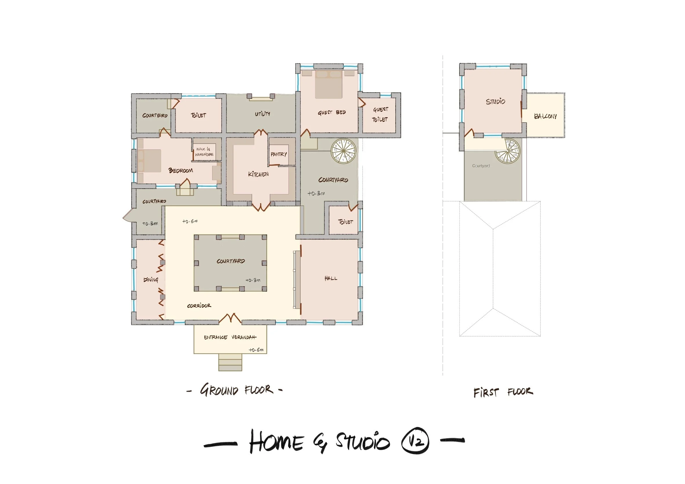
Draft layout 2
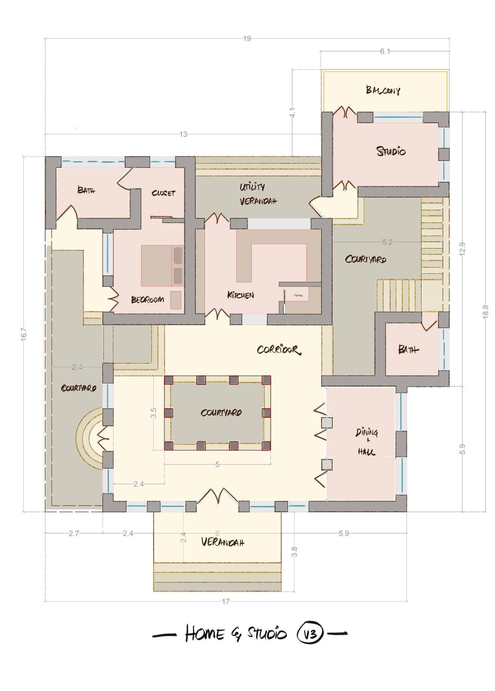
Draft layout 3
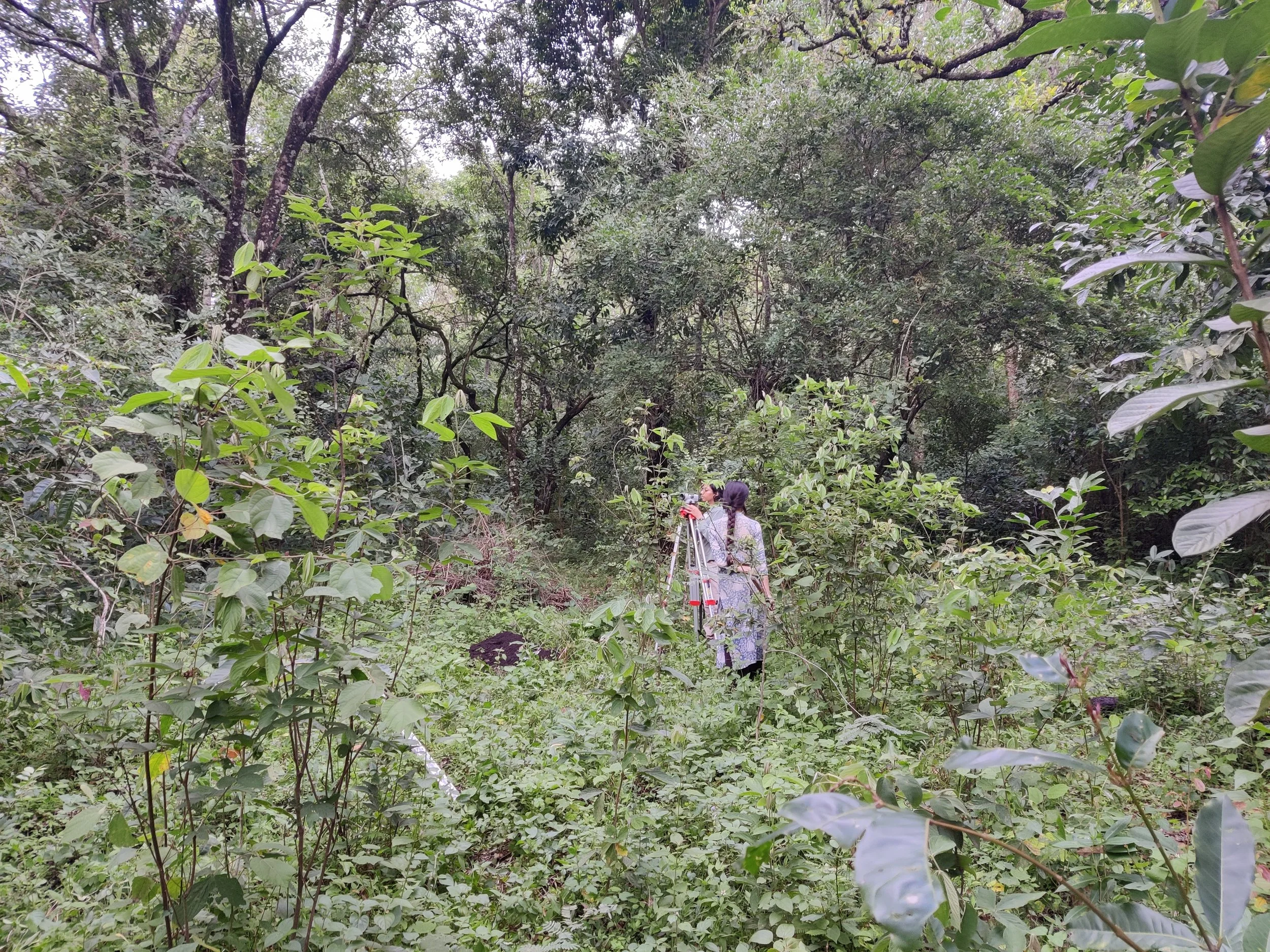
Preliminary auto-level survey, to select site
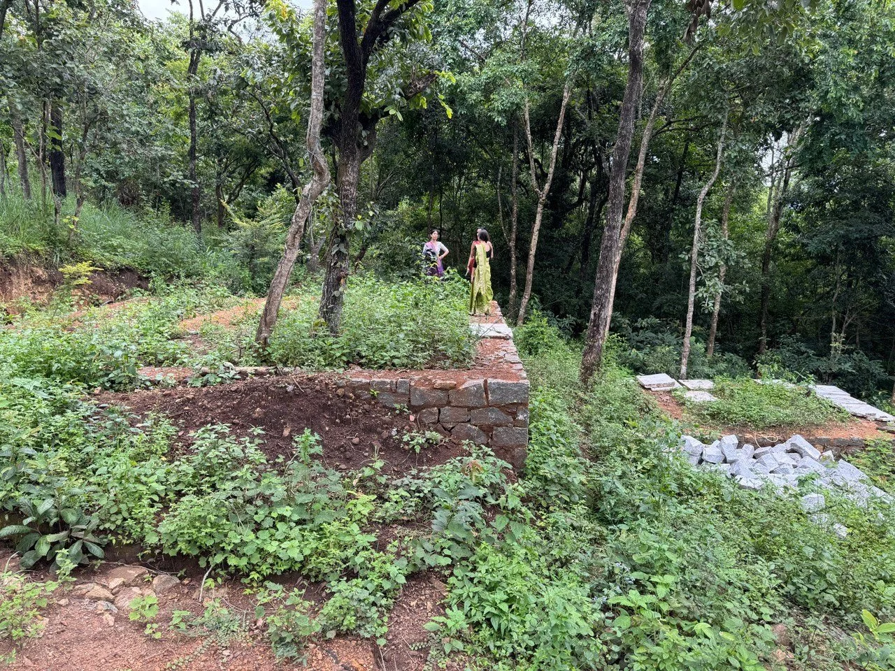
Home under construction
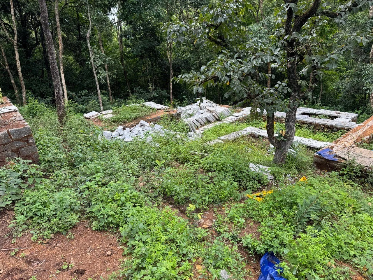
Home under construction
Home layout - 3D views