

What to ask for in a Contour Survey
The first step once you buy land is to do a comprehensive contour survey of the land. A contour survey map is a map that contains information about all existing features of your land, especially the topography. The topography is represented by contour lines - lines that connect points of equal elevation on the land. However, there are other elements to request in a contour survey to ensure a thoughtful and ecologically sensitive approach, and to ensure that one can begin with a detailed map of all that exists on ground:
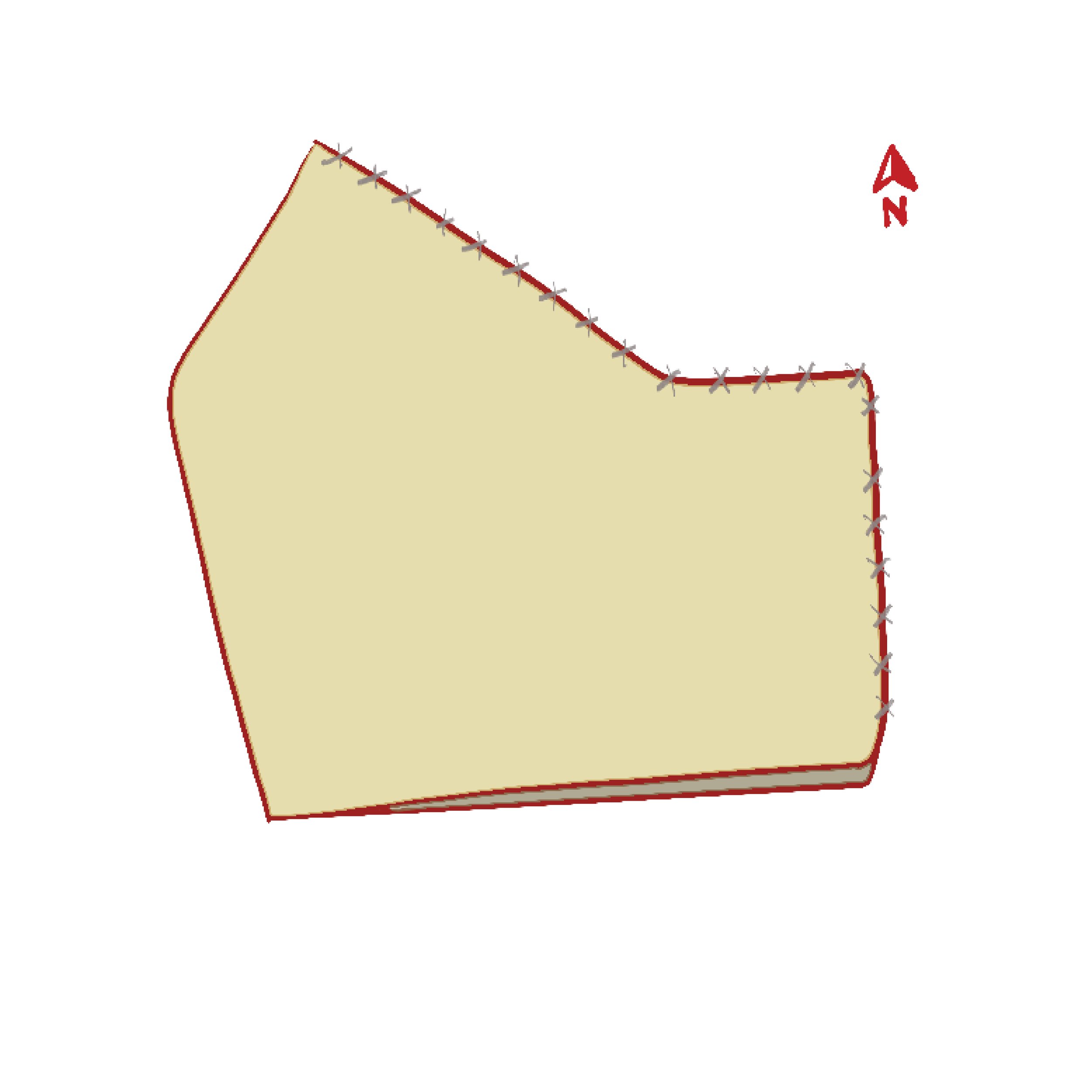
Boundary and Fencing:
Boundary and fencing surveys may include the following:
Clear/distinct/precise boundaries
Unclear / disputed boundaries
Dimensions of the land
Extents of kharaab land if applicable
The boundaries can be fenced edges (chain link, barbed wire etc.) and/or unfenced edges.

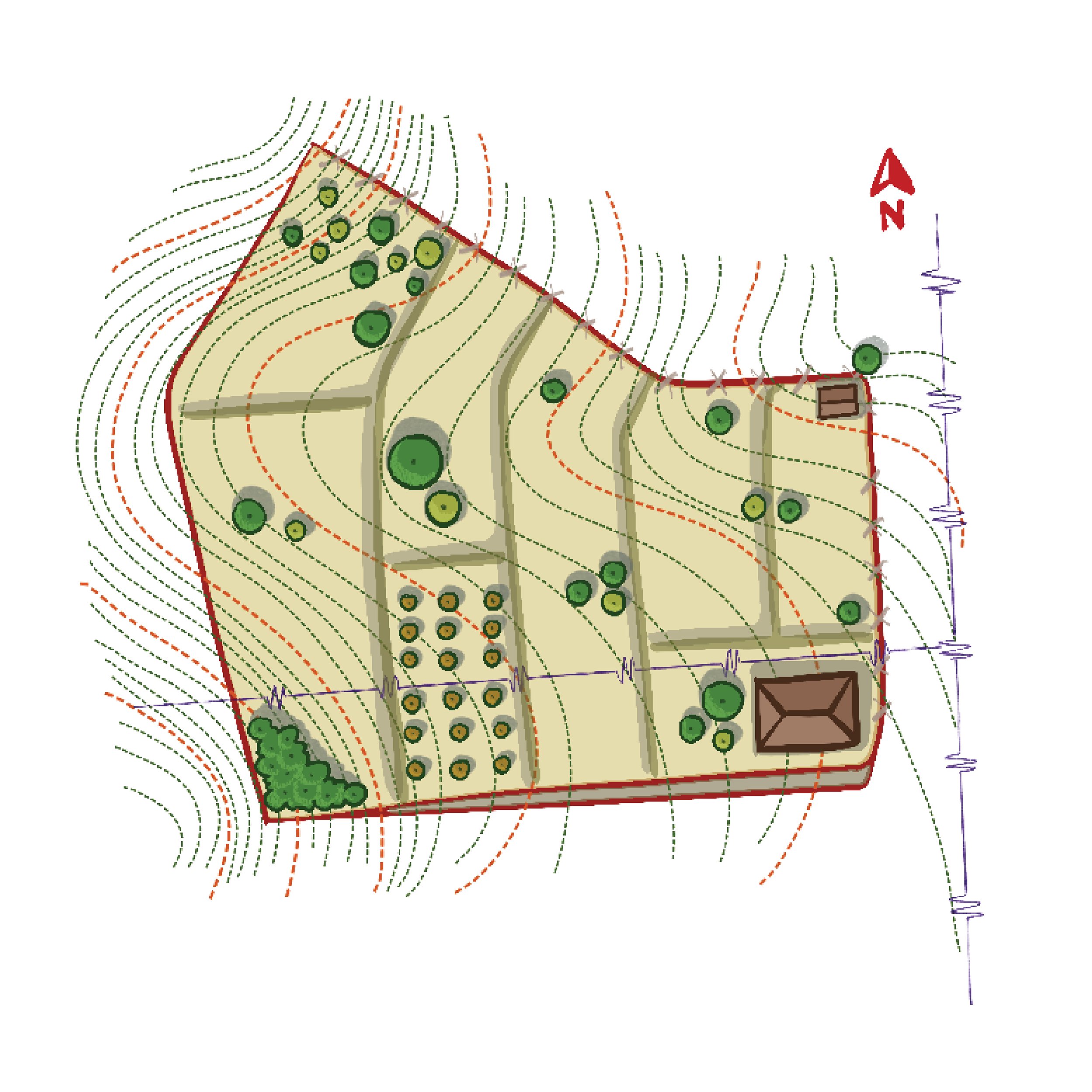
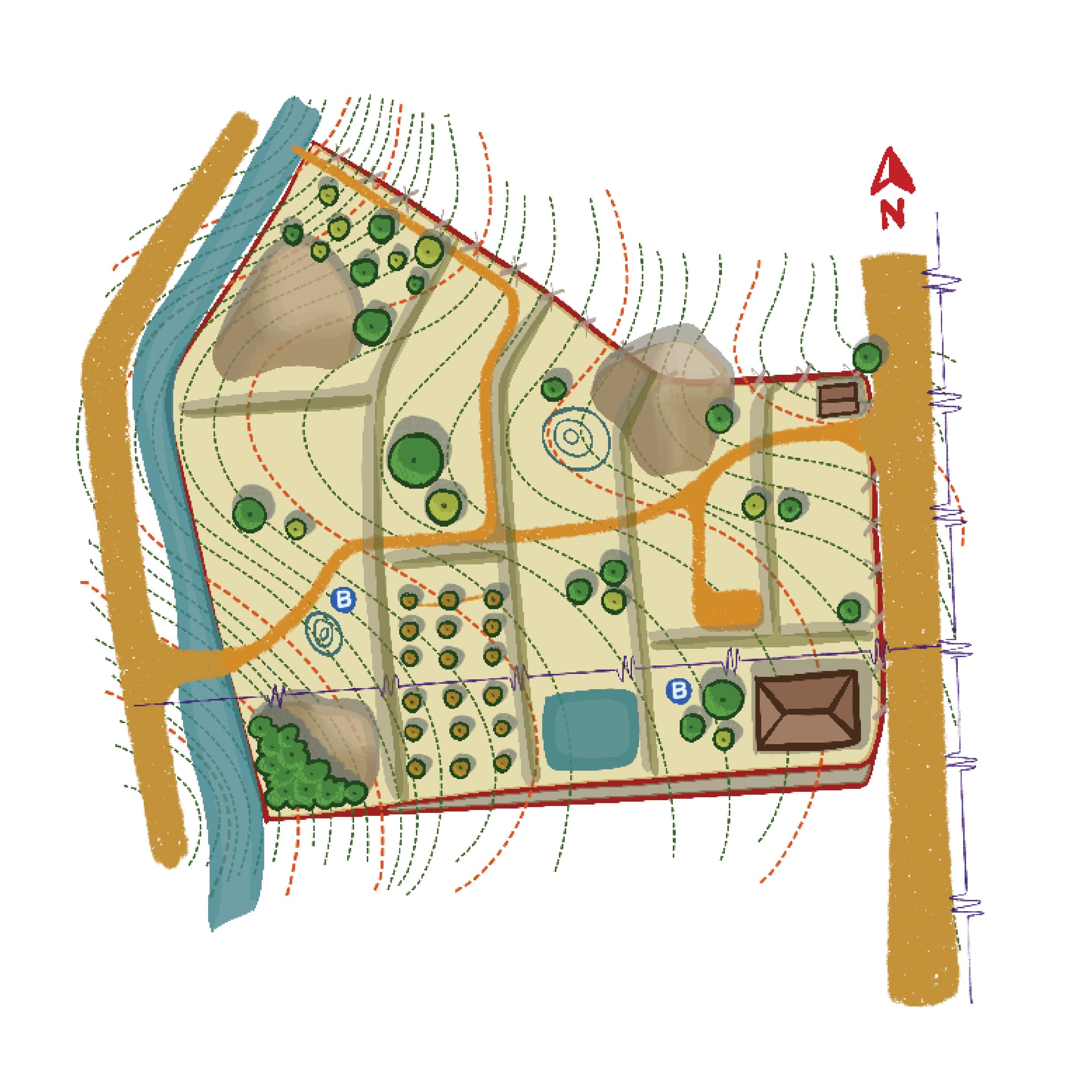
Fig 1: The site boundaries highlighted in red.
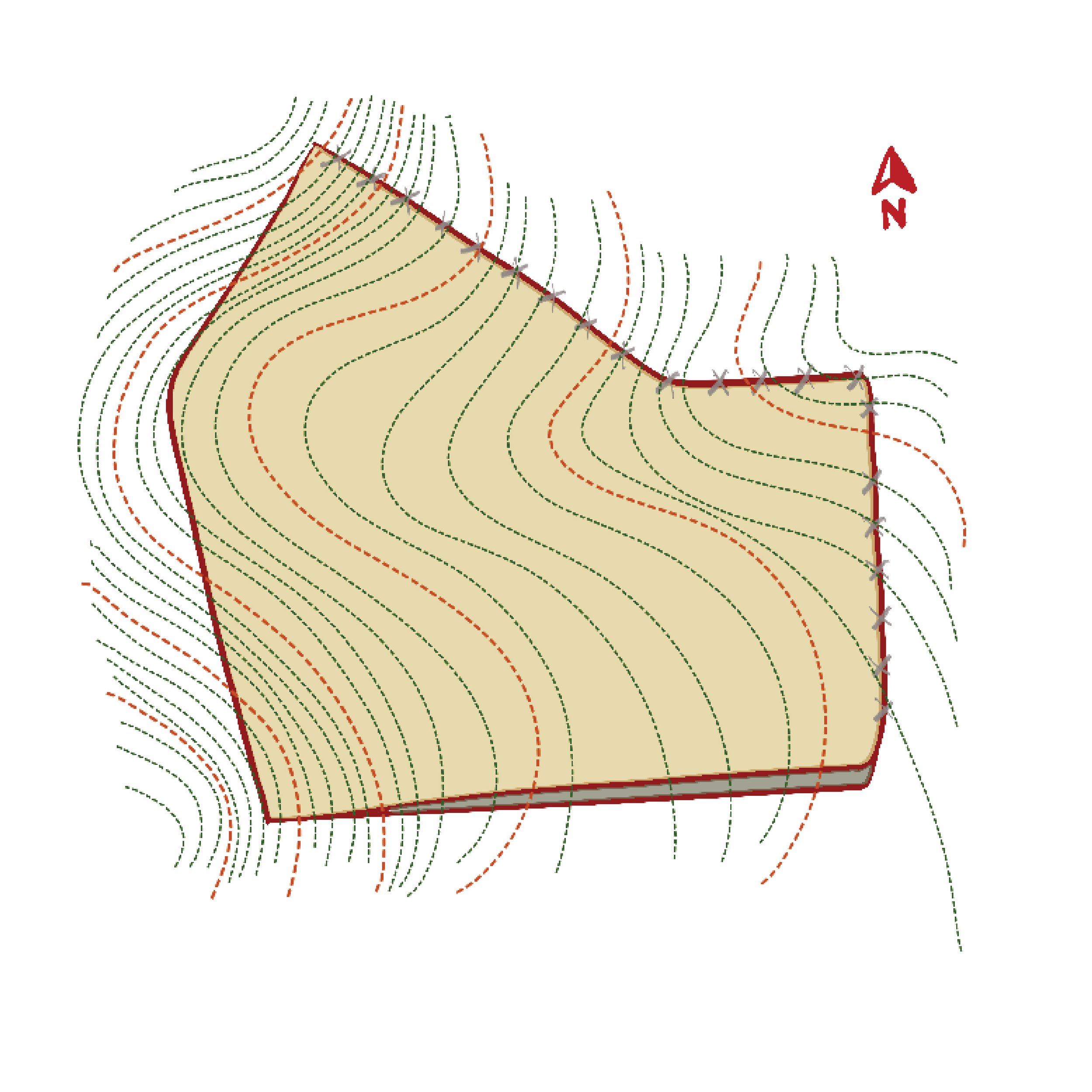
Contour lines
The purpose of contour lines is to represent the 3D shape of the terrestrial surface on a 2D map.
0.5m contour interval is preferable and necessary to know detailed topography
For very large lands, one can begin with 1m interval
For smaller lands, 0.25m interval is better
Contour lines should extend beyond the site as well

Fig#2: The concentric lines (marked in red dotted line) showing contour lines at 1m interval.
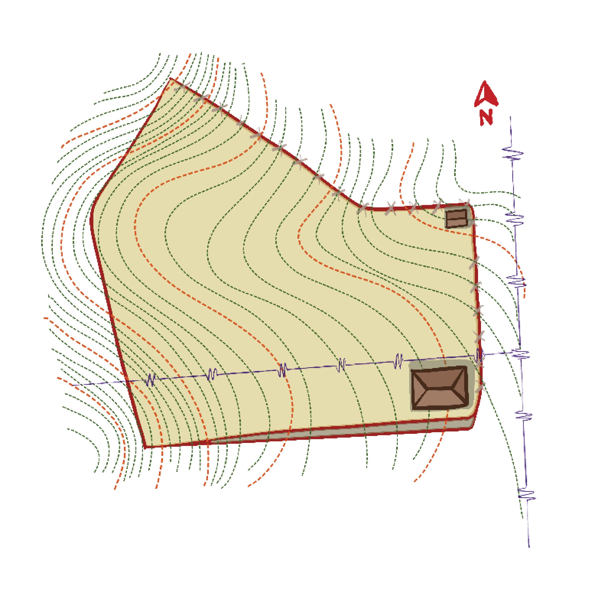
Built structures
Roof plans of existing structures
Floor plans of existing structures if available
Dimensions
Details on what the structure is (shed, home, staff quarters, barn etc.)

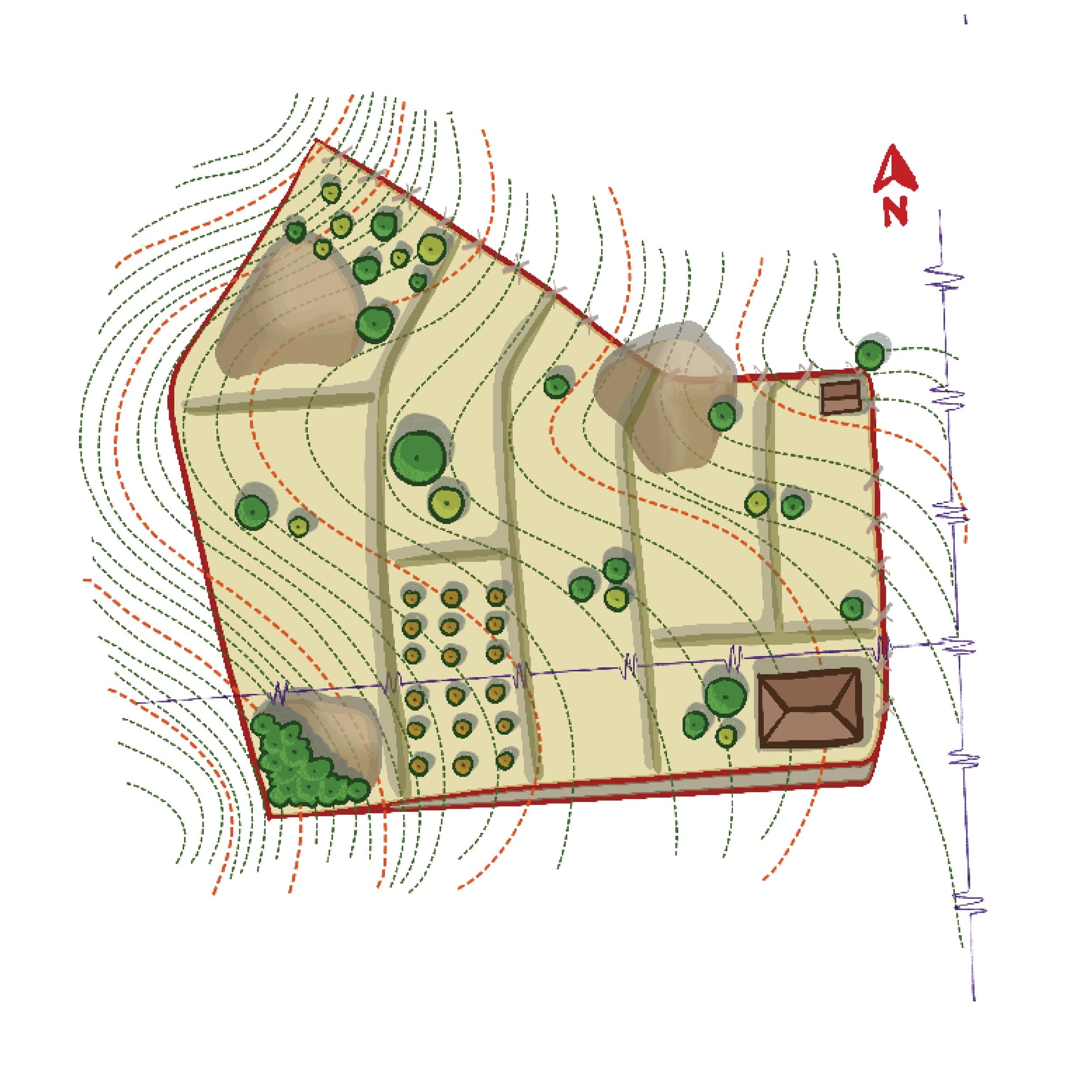
Fig#3: The figure shows the central built structure with dimensions and topography.
Power lines, with
Location of utility poles and over-head power lines
Location of transformers and transmission towers if present

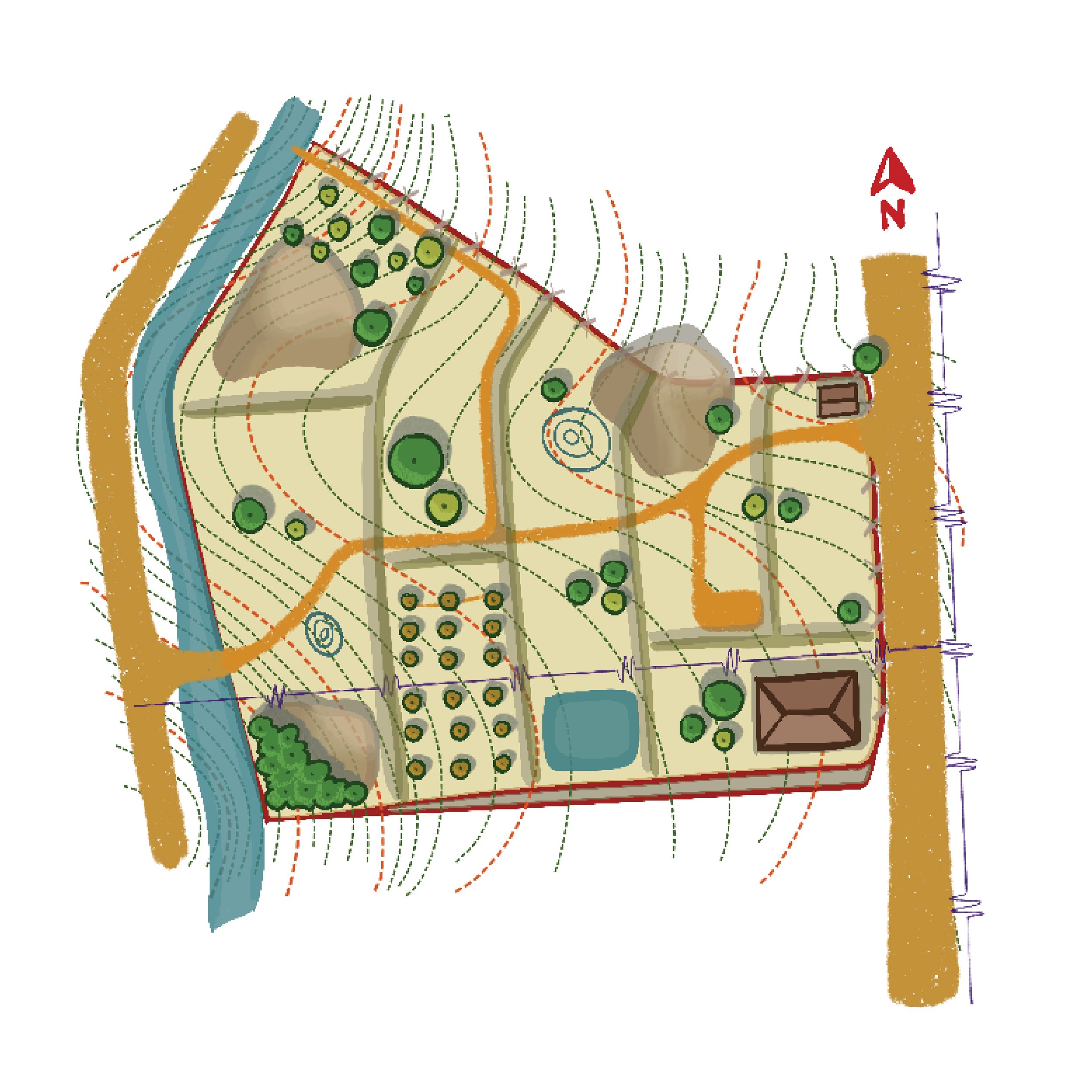
Fig#4: The figures shows the power line (marked in yellow).
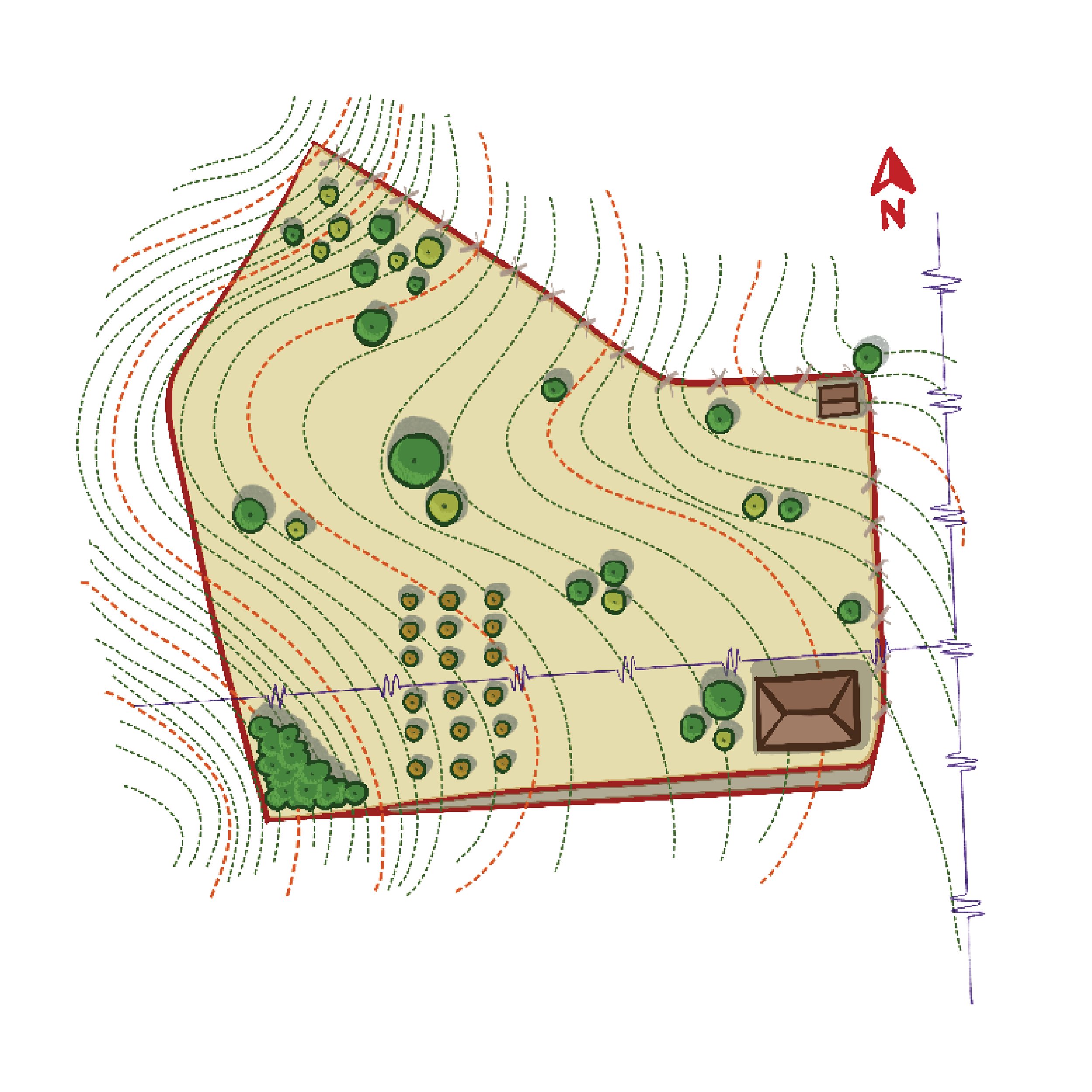
Vegetation
The vegetation is a significant indicator of the biologically active zones/biodiversity zones, invasive species and may signal the presence of groundwater distribution. It includes the following:
Mature trees, grassland and shrubs
Fruit and flower orchards
Identified species and species density in a particular part of the land
Girths of mature trees
Canopy extension and ground cover

Fig#5: Figure shows the distribution and variety of trees across a particular area.
Field Bunds and Terraces:
Field bunds and terrace structures on a map include (mostly) artificial sloping/compartmentalizing of the land.
Planning around these bunds/existing earthworks along with contour data can be beneficial while designing and implementing the design.
Water bodies with levels:
The following water bodies can and should be present on a base map.
Ponds
Nalas
Streams/Springs
Rivers
Wetlands
Tanks
Depressions
Seasonal puddles

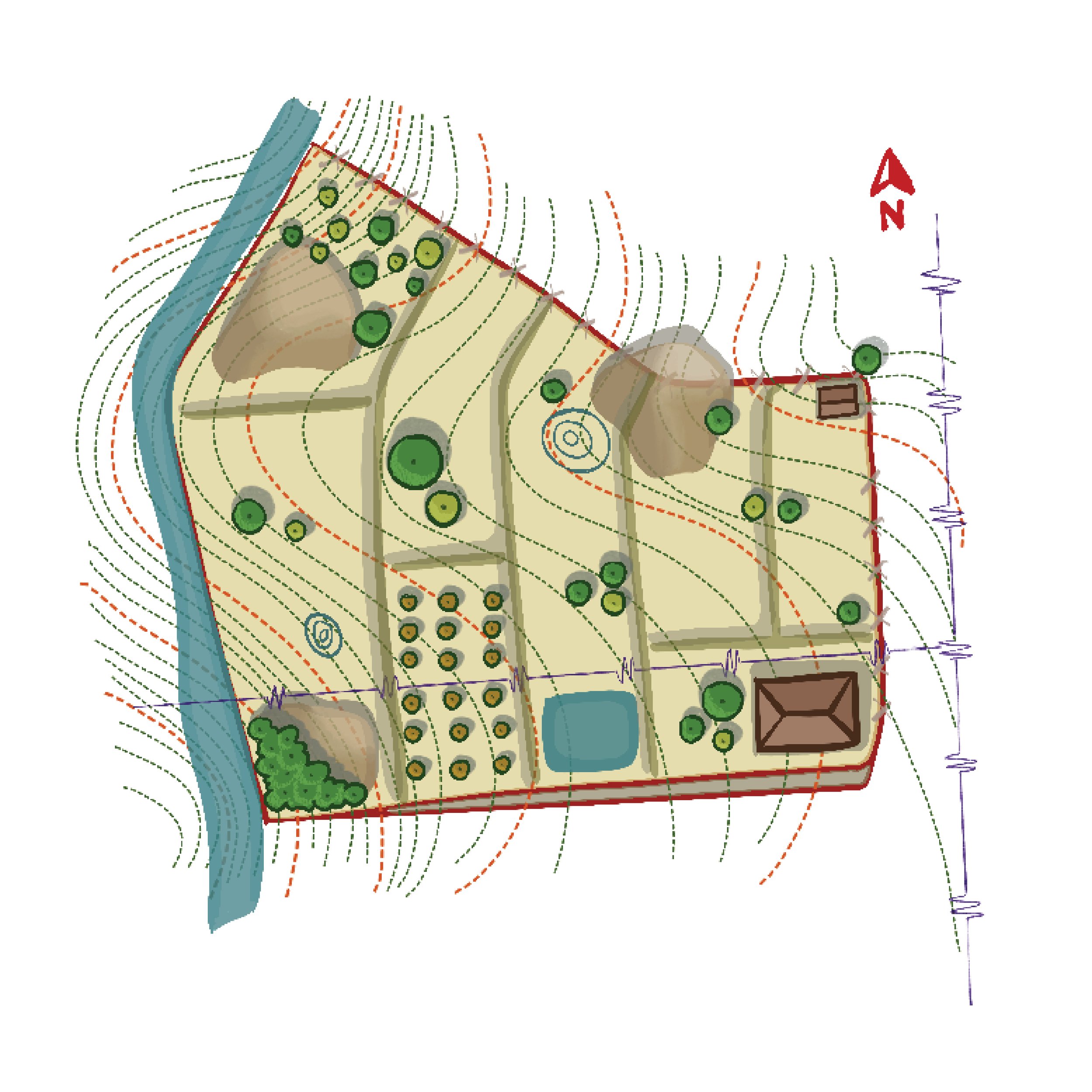
Fig#6: Survey map showing water bodies in, around and entering the land.
Roads and Pathways:
All-access roads, paved / unpaved, that run adjacent to the land, with levels
Type of road (tar, concrete, mud, etc.)
Width of road
Walking paths across site
Widths of the same
Type of pathway (mud, gravel, paved, etc.)

Fig#7: Figure shows access roads (in brown)
Borewells & open wells
Locations of borewells and open wells
Dimensions of open wells
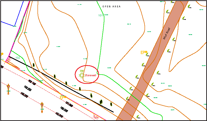
Fig#8: Survey map showing the borewell (marked in red)
Other important features that can be included in the map:
Soil mounds
Trunks of trees that have been cut
Termite mounds
Historical structures
Gravestones / graveyards
Temples or shrines
Utility lines (water, gas, etc.)
Land use of the neighbouring lands (orchard, forest, agricultural land, etc.)
Bus stops adjoining the land
The more detailed the contour survey map, the easier it will be to read the land and start planning it. Some information needs to be included in the contour survey - boundaries, contour lines, tree locations, built structures, field bunds & terraces, power lines, roads, rock outcrops. Other information can also be marked while walking the land with the contour survey in hand.
Finally, the contour survey map should be in two formats, PDF and CAD, for ease of use while designing.
Happy surveying! :)